
Two nonstop trips from Shoreham EGKA, UK, to the Alps, March/April 2021, and one UK-Croatia via the Alps
This article describes two nonstop flights from Shoreham EGKA, UK, to the Alps and back, and one "flypast" on a UK to Croatia trip. The idea, originally discussed here, was to get some great photos and videos of the mountains during the snow season. Then coronavirus arrived...
The first two were done during the toughest period of the coronavirus lockdowns. It was an utterly bleak time for most people - well except assorted "criminals" selling Chinese masks for £10 each, and ripping off the NHS with millions of the same stuff! Nobody in government knew what to do other than to "lock everything down" and the result was a lot of often-hysterical restrictions, plus a great deal of enthusiastic over-interpretation of whatever regulations actually existed. Nobody does as much over-interpretation as pilots, some of whom wear yellow jackets while eating lunch at Le Touquet! Flying was permitted in most countries, but many airfields closed, probably because cafes were closed by law except - in the UK at least - for takeaway food (which doesn't make much money). My base, Shoreham, and unlike so many airfields, never closed during coronavirus lockdowns, and I flew locally every 1-2 weeks throughout, usually choosing an overcast day and flying in IMC or above, to avoid the airport getting complaints. There was a restriction on leaving your house "without a good reason" and the law listed some acceptable reasons, but the list was non-exhaustive so it didn’t mean much. You would need to be prosecuted and a court would determine whether your reason was "good", and it was clear that there was practically zero enforcement, which is typical of the "soft" UK approach. Well, some police officers went over the top in the early days but soon gave up when it turned out that most of the fines they issued were done illegally. Stupidly, somebody asked the CAA for "guidance" so they produced some, along the lines of it being ok to fly as required by the engine manufacturer's recommendations to prevent engine corrosion. The Lycoming requirements for engine running - Service Letter L180A - says minimum 1hr every 30 days or less. So that SL became the blanket permission to fly the aircraft! Still, many airfields, eager to look "socially responsible", banned non-based arrivals... For these flights, I contacted the police and established as far as was possible that they would not take action, and flew with everything printed out in a folder. Ultimately, the max fine was only £200 for a first offence; I had that ready too, in case the alternative was a visit to a police station (a ~90% chance of catching the virus because they basically took no precautions and had mostly got it). At the time of the first two trips, I had one vaccination of the two.
I also contacted the police to find out what documentation they require for a circular flight going outside UK airspace. They had no idea, so they asked head office which ruled that one cannot catch the virus while flying an aircraft solo (we can see why UK prisons are overflowing: with such sharp law enforcement, criminals have no chance ![]() ) but that the GAR form (a declaration required before entering the UK; in general 4hrs before and in some cases 12-24hrs before) and the PLF (passenger locator form) are both needed; both of these are nonsensical for a circular flight and there is no legal basis for demanding them, but you never argue with the police. However, they usefully confirmed that I can refuel abroad and provided I remain in the aircraft I don’t need to quarantine; this is anyway standard practice for commercial pilots otherwise aviation would have ground to a halt. It's probably impossible to refuel a GA aircraft without exiting it, and this "rule" is normally modified to "remain airside". In fact they could stay in hotels too although in many/most countries they need tests for that. I was doing everything to avoid an overnight situation and carried a tent and everything needed to stay overnight. However the tent would merely avoid having to find a hotel (which can be a challenge in provincial France even in normal times, if you arrive late) plus an overnight stay abroad would definitely trigger a quarantine back home. In any case most airfields don't allow camping airside...
) but that the GAR form (a declaration required before entering the UK; in general 4hrs before and in some cases 12-24hrs before) and the PLF (passenger locator form) are both needed; both of these are nonsensical for a circular flight and there is no legal basis for demanding them, but you never argue with the police. However, they usefully confirmed that I can refuel abroad and provided I remain in the aircraft I don’t need to quarantine; this is anyway standard practice for commercial pilots otherwise aviation would have ground to a halt. It's probably impossible to refuel a GA aircraft without exiting it, and this "rule" is normally modified to "remain airside". In fact they could stay in hotels too although in many/most countries they need tests for that. I was doing everything to avoid an overnight situation and carried a tent and everything needed to stay overnight. However the tent would merely avoid having to find a hotel (which can be a challenge in provincial France even in normal times, if you arrive late) plus an overnight stay abroad would definitely trigger a quarantine back home. In any case most airfields don't allow camping airside...
A real complication would arise if there was a technical issue with the aircraft. Landing away from base, outside the UK, while always permitted for refuelling reasons, was hazardous because entry to any of the countries in question would have resulted in being taken away into quarantine if the aircraft had a problem departing (weather, engine starting issue, etc). So these trips were planned to be done without a landing, and this had to be achievable with a high degree of probability.
On all three, the objective was to photograph and film the summits of specific mountains, from close-up:
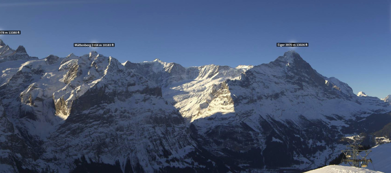
1) Jungfrau, Mönch, Eiger
2) Mt Blanc
3) Finsteraarhorn, Weisshorn, Matterhorn, Monte Rosa
All were successful, although 1) and 3) suffered from sudden ATC issues over Switzerland "due to military activity".
All flying was done IFR in the Eurocontrol system, with VFR sections to shorten the total distance (basically gaming the Eurocontrol validation software) and to enable "free flight" over the Alps.
Here is a glossary for non-aviation readers.
Pilot
FAA CPL/IR, UK/EASA PPL/IR, ~2800hrs.
Aircraft
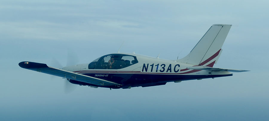
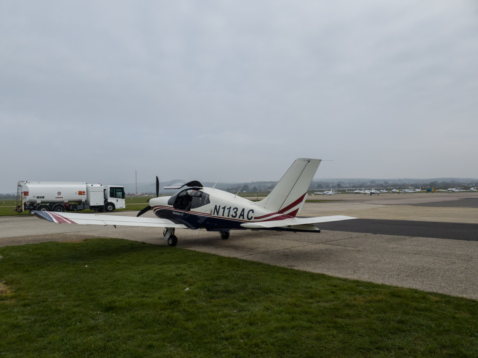
The aircraft is this 2002 TB20GT; one of the last made before production ended. This photo was taken in 2018 on a flight between Crete and Karpathos, in Greece:
In January 2018 a full TKS ice protection system was installed. This was a big job, with numerous nontrivial aspects, but the end result was well worthwhile in expanding the operating envelope, by enabling safe penetration of non-convective icing conditions - basically icing layers which can be climbed or descended through fairly quickly. It was good to discover afterwards that the TKS system did not affect the cruise speed - something of a problem on other TB20 / TB21 installations where a speed loss of 5-7kt had been reported. The above pic shows the not yet painted TKS fluid refill door, just left of the "3". There is a payload loss of 50kg (with a full tank of fluid) which makes the TB20 a 2-seater if doing a trip with a lot of stuff. The system is totally effective against any icing conditions I have encountered but in those conditions it will empty the tank in around 1 hour! And the sticky fluid makes a mess; it is best to wash the aircraft down after such a flight with some hot water.
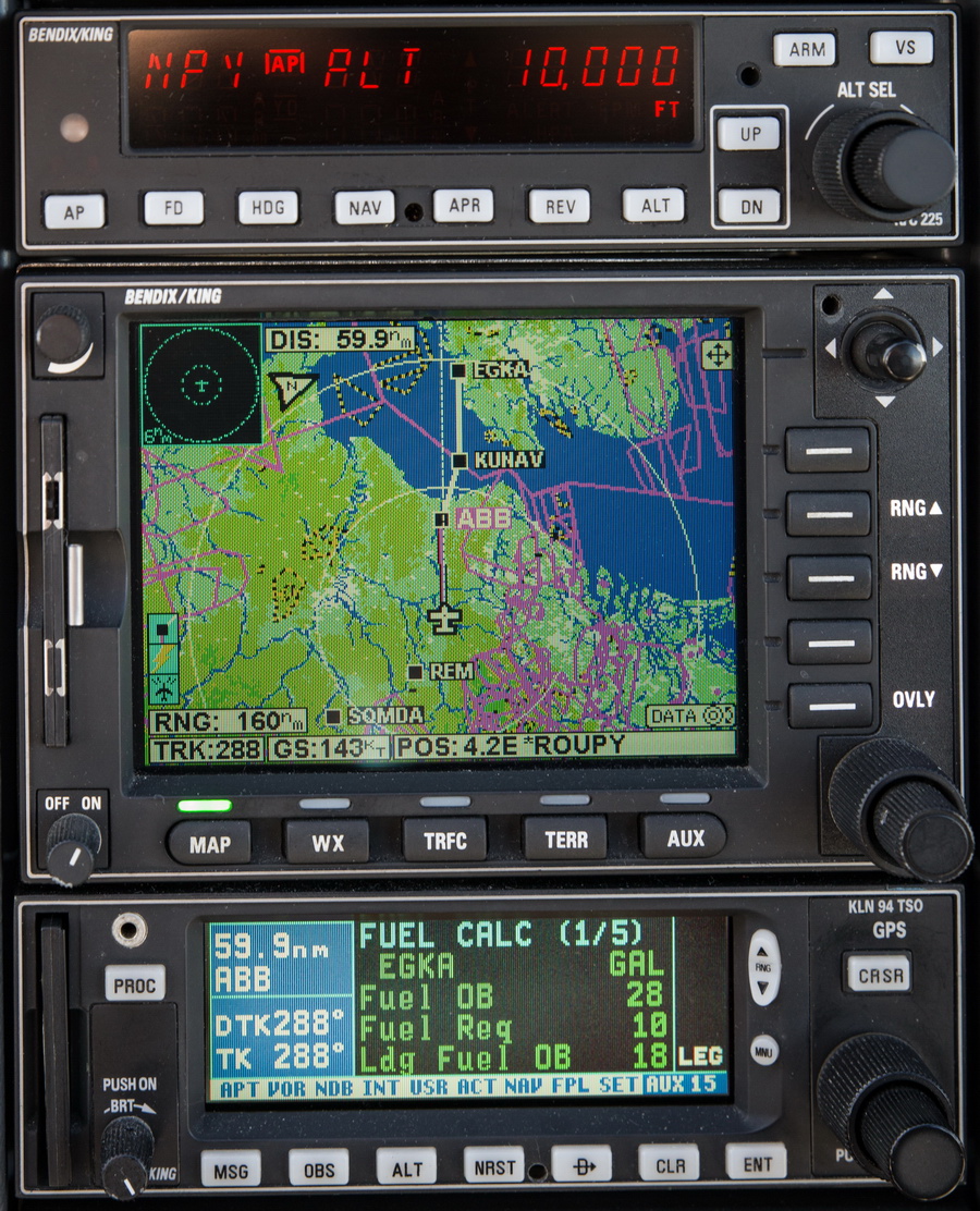
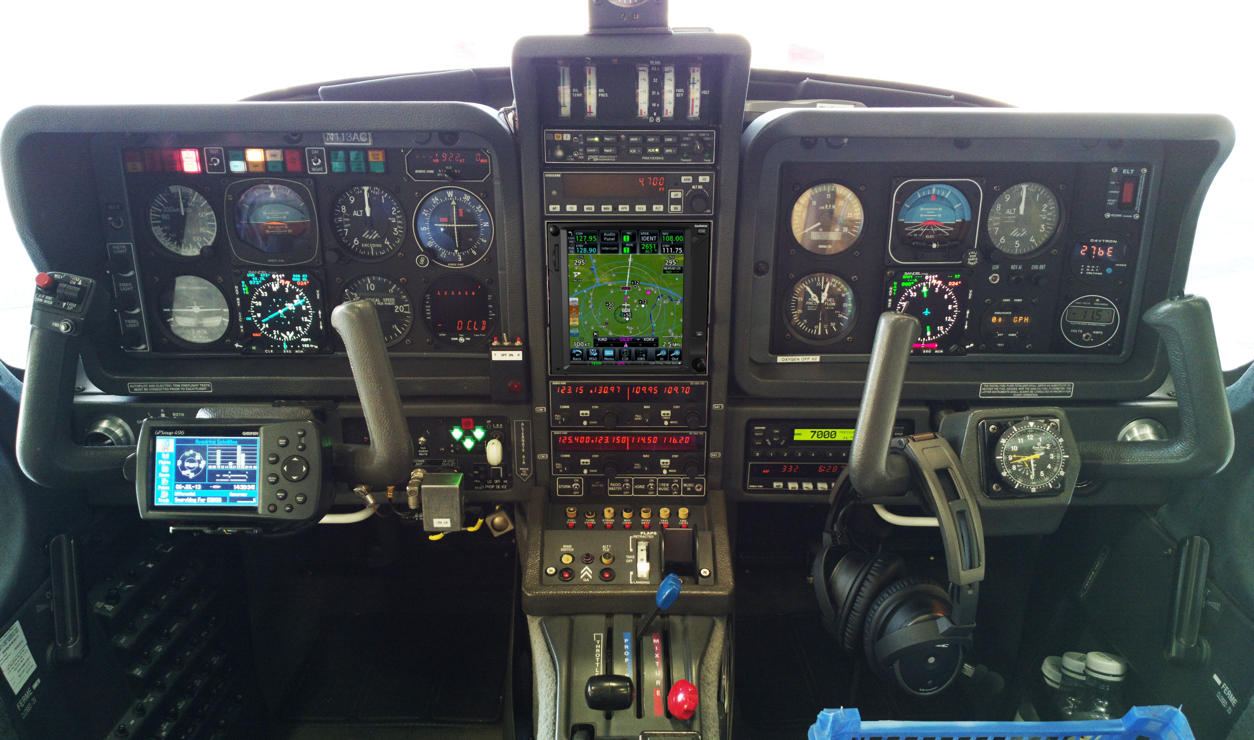
The aircraft is equipped for BRNAV (RNAV 5) and can fly ILS and GPS/LNAV approaches using the autopilot. This is sufficient for current European IFR flying. The cockpit is largely as delivered in 2002, with a Sandel EHSI installed in 2011 on the LH side and with the RH side later reworked with another Sandel EHSI and arranged to form a usable "pilot panel" so the aircraft can be flown from the RH side.
There is no LPV approach capability but LPV is not yet (to me) operationally relevant in Europe especially if flying to/from the UK which normally needs an airport with Customs/Immigration. France is ahead of most countries in removing ILS approaches (from airports not served by airlines) and replacing them with LPV. Adding LPV capability (which also gives you the very useful "+V" advisory glideslope on most GPS approaches) could be done with a cheap-and-dirty solution of a used GNS430W, but that would leave various dysfunctional loose ends, and a decent installation would be a Garmin GTN650+GTN750 (or just the 750) or Avidyne 2xIFD540 (the foregoing links are photoshopped mockups) and these jobs would cost about 30k but much more importantly I don't know of any installer who I would let loose on my aircraft on which I value the virtually 100% uptime!
The aircraft has an operating ceiling of 20,000ft in ISA conditions. I have taken it to 21,000ft but in the fairly common summer conditions of e.g. ISA+15 it will reach at most 18,000ft at MTOW.
This is the current panel, with the Aera 660 GPS on the LH yoke; this is wired to the intercom to provide a GPWS function with audible warnings in the headsets, as well as providing an emergency "DCT box" for navigation following a total loss of electric power. The Aera 660 is shown running the Garmin Safetaxi product which makes it a lot harder to get lost at a big airport ![]()
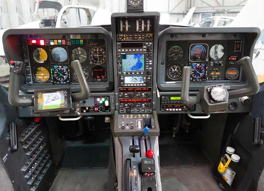
The Golze ADL150 satellite weather receiver was also installed in January 2018. This gives simple but usable graphical weather data for most of Europe, plus tafs and metars. With an upfront cost of around €500 and monthly costs of around €25 this is one of the best add-ons one can install in an IFR aircraft.
Routes
The IFR routes were developed with a mixture of methods. The Autorouter is the most popular tool for light GA, and is currently free. It can also file flight plans. The only other options for autorouting are RocketRoute (over €200 a year) and Foreflight (around €100/year). Foreflight dominates the US market and is working on a European version, but it isn't there yet in terms of required functionality. For VFR flight plan filing I use EuroFPL. I also use EuroFPL for filing IFR flight plans as a backup, or for unusual situations e.g. where a specific ETA must be filed (to fit inside a purchased airport slot) and the Autorouter aircraft performance model does not allow that. With the demise of FlightPlanPro (one of the original autorouting tools, from 2008, whose source code later formed the basis for RocketRoute) the lack of a realistic backup for the Autorouter is a concern to many pilots... I have already found problems with delaying flight plans, for example, which works via the telegram interface but not via the website.
In case the Autorouter disappeared while on, or shortly before, a trip like this, I generate the routings before leaving home and save them in a file which I email to myself. Then I could use one of the other flight plan filing tools (e.g. EuroFPL, or at worst AFPEX) to file the flight plans. This is not 100% reliable because a flight planned route may no longer be valid a week later, but it usually works, or may just need a little tweak.
Some notes on IFR in Europe are here.
On these flights, the route development was a challenge. The Autorouter is incapable for developing a route which starts and ends at the same airport! Discussion here. It "can" do it but the routes tend to form huge ovals and are basically nonsensical. A better result is obtained by developing the two routes separately and then joining them manually. This method is considerably assisted by most of the flight being over France, and France generally allows (both in terms of Eurocontrol validation, and in practice) flying the same route in both directions. Well, below FL200, anyway... This worked eventually, but still failed for the Mt Blanc flight, which after more hacking was validated and filed via EuroFPL.
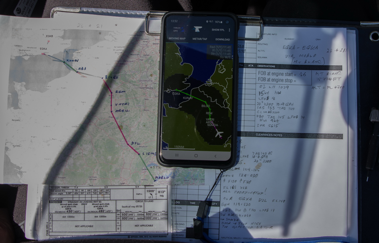
Many pilots fly "fully electronically" nowadays but for any significant trips I always prepare a printed paper package comprising of the route pic, a plog (a waypoint list; this is rarely used since the route picture shows most of the waypoints, and the flight is done with GPS navigation), and the terminal charts for the departure, destination and alternate(s). For terminal charts for unplanned airports I have a collection of PDFs on various devices including my phone. The advantage of paper is that the battery can't go flat ![]()
Weather sources
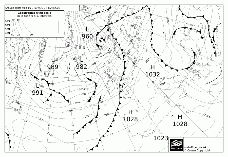
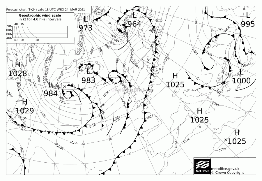
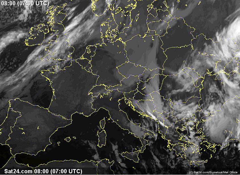
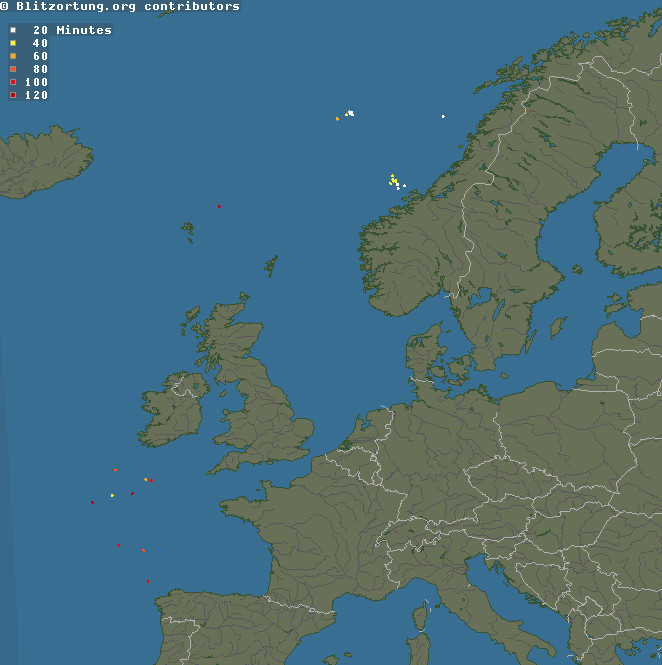
For many years I have been using tafs, metars, radar, IR (infra red) images for cloud tops, sferics (lightning) for convective activity, and the UK Met Office MSLP charts for the general picture.
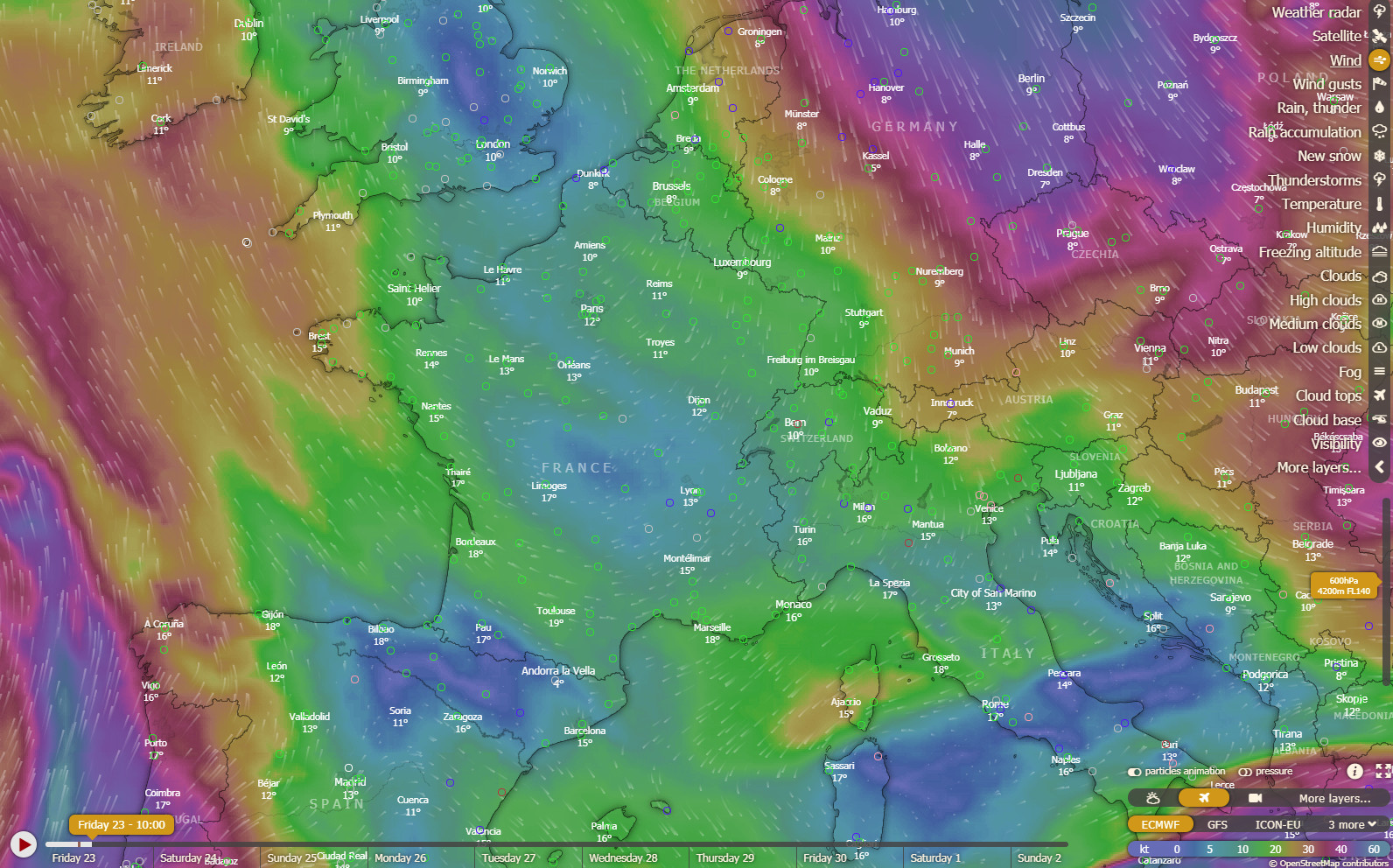
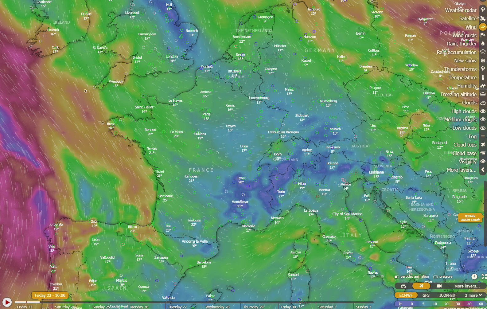
The Windy.com website is a new addition to the set of weather tools and is proving to be nothing short of a revolution. In addition to the US GFS model, it offers three new European weather models - ICON NEMS and ECMWF. I find ICON to be useless. Best is ECMWF which is generally better for Europe than the GFS model which was universally used by pilots beforehand. European weather data has always been tightly guarded as a "commercial secret" so everyone used GFS, which was freely provided by the US. Somehow, Windy.com is able to offer these new weather models. The wind visualisation at different levels is very good; of course it is no more accurate than the weather models but it offers an easy way to assess which route is likely to get the worst or best winds. In reality I have found it to be within 10kt, usually. For IFR pilots, the "rain and thunder" layer is perhaps the most useful one for an initial "quick and dirty" look.
However, mountain trips bring in a new dimension: you really want to be assured of VMC conditions at a level which the aircraft can climb to. TKS works but with a ~1hr fluid endurance, and if you get an electrical failure over the mountains you will be in big trouble... And on these trips we definitely wanted good VMC conditions to get good photos and movies! This beings us to the use of mountain webcams, of which there are plenty, but obviously are useful only just before a flight.
All three flights, and especially the first two, were pushing the envelope of the TB20 range. Wind can have a huge effect at the relatively slow speed of the TB20 - around 140kt when on economy cruise. On the circular flights the two legs were almost identical so the wind largely cancels out, but of course it does not cancel out completely because the nature of the wind triangle geometry is that any wind brings a cost, because you are flying the hypothenuse of a triangle, which will always be at least as long as the direct distance. Calculations were done to work out the effect and it was small for absolute values of wind under say 30kt, and negligible below 20kt provided it does not change significantly during the trip. You could get lucky by flying clockwise around the centre of a High and get tailwind on both legs, but Highs move very slowly relative to a 6-7hr flight and an oval route was not possible in France due to the whole east part of France being totally blocked in by the Paris TMA on one side and military areas on the other side, and French ATC almost never allow any transits of these. In fact it is obvious they almost never even try to coordinate, despite telling you they will ask. ATC gets a lot better in the SE corner of France, next to Switzerland, but the military areas there are still almost totally no-go. The flights would have worked better on a weekend, when the French military are mostly closed, but my base had 2hrs shorter opening times at weekends, and due to the flight time I needed the full opening times.
Trip #1 - Shoreham to the Alps - Jungfrau, Mönch and Eiger - March 2021
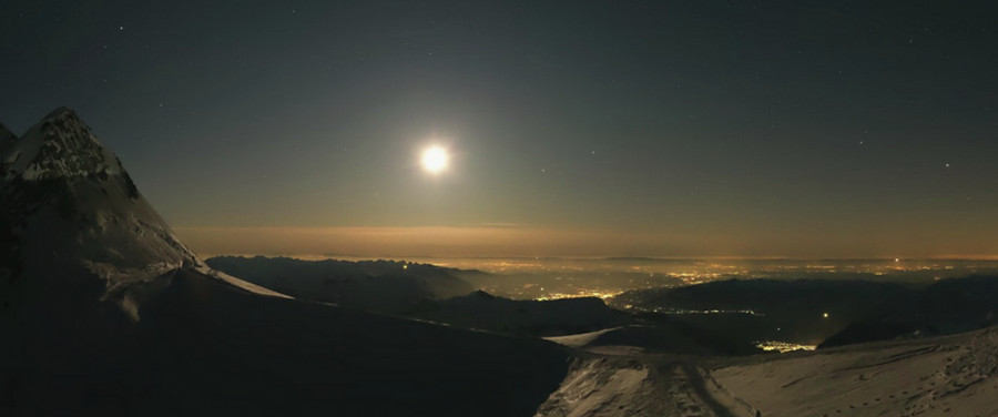
Due to the need for perfect weather over the Alps, good weather enroute, and winds not too strong, this flight was "looked at" on an almost daily basis for weeks beforehand. The ultimate determinant was the Alpine weather and for that there were various webcams, especially a very high quality webcam at the famous Jungfraujoch restaurant, which on the day of the flight produced this beautiful image, at 2am
I went back to bed but obviously didn’t get any more sleep so this flight would be done with a thermos flask of Justine's mocha ![]()
The other weather sources showed a good day: MSLP 0600 1200 1800. Other webcams were good: Eiger some nearby one Jungfraujoch. IR image Sferics. Mid-day wind TAFs and METARs
The one bit of concern was the 800ft forecast cloudbase forecast for Gatwick, but Gatwick is significantly above Shoreham in elevation. This made the Biggin Hill ILS important; recently it had been notamed INOP due to maintenance work and that alone prevented the flight. Also the RNAV02 at Shoreham was possible, with a tailwind landing. Lydd airport was closed most of the time, and local flights revealed that they turned off their ILS - presumably to prevent somebody using it for instrument practice without paying; the tower was officially closed and in the UK you cannot land at an unmanned ATC airport no matter what your reason! The Windy.com cloudbase forecast confirmed what one might expect. Biggin Hill was telephoned the day before to check everything is working. Lille was also contacted by email and it was carefully verified that one could do a refuel without any coronavirus tests or quarantine being imposed, and - very importantly especially in France - there will be assistance for the avgas pump, because I can't speak French and have in the past been unable to operate the French-only pumps, delaying the onward flight by several hours which predictably caused big problems later.
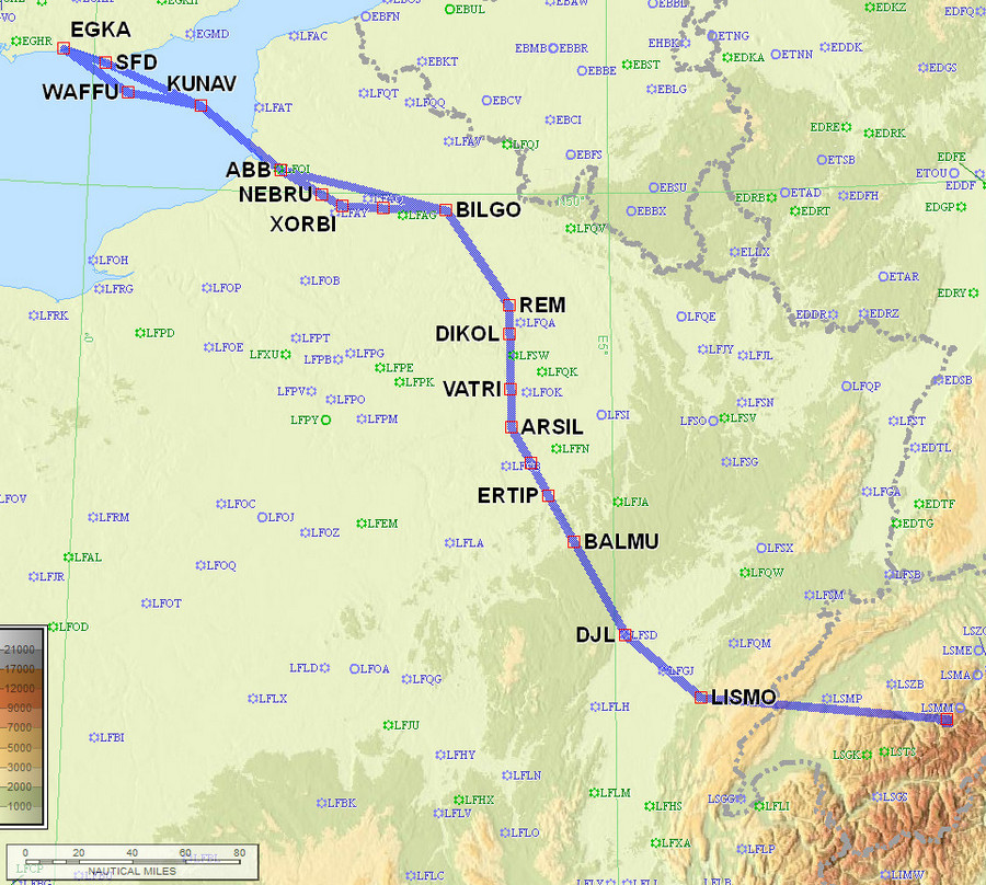
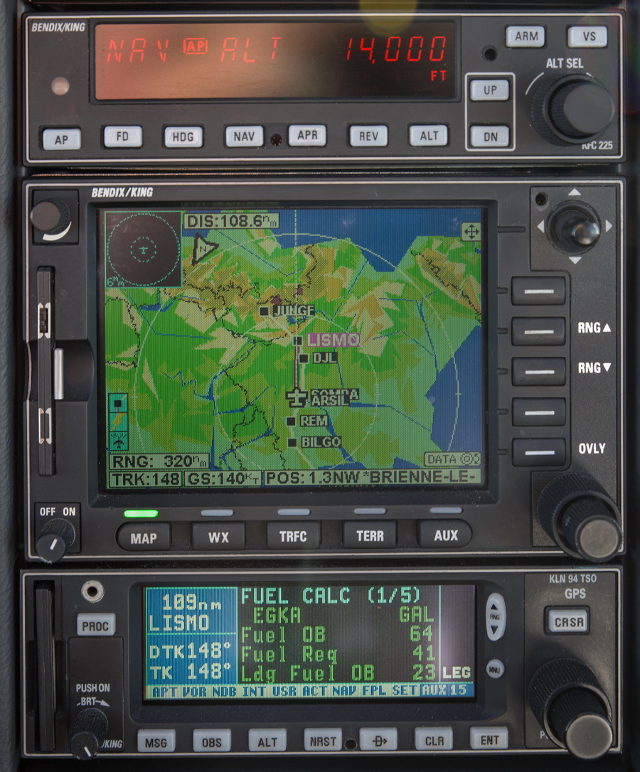
The route was filed for FL040 initially; that is just nonsense to get Eurocontrol validation. One is often playing games with the validation software ![]() The route starts off with an IFR departure, then quickly changes to VFR until VATRI, then IFR, then it changes back to VFR for the entire Alps portion, then back to IFR for the return flight, then VFR for the last bit to the UK to shorten the distance. The various level changes are to game the validation system and are almost never flown. The speeds are basically fiction too because a non-turbocharged aircraft, at FL080 or above, is flying with a wide open throttle and at peak-EGT or lean of peak (LOP) and the speed is whatever you get. This is the filed route:
The route starts off with an IFR departure, then quickly changes to VFR until VATRI, then IFR, then it changes back to VFR for the entire Alps portion, then back to IFR for the return flight, then VFR for the last bit to the UK to shorten the distance. The various level changes are to game the validation system and are almost never flown. The speeds are basically fiction too because a non-turbocharged aircraft, at FL080 or above, is flying with a wide open throttle and at peak-EGT or lean of peak (LOP) and the speed is whatever you get. This is the filed route:
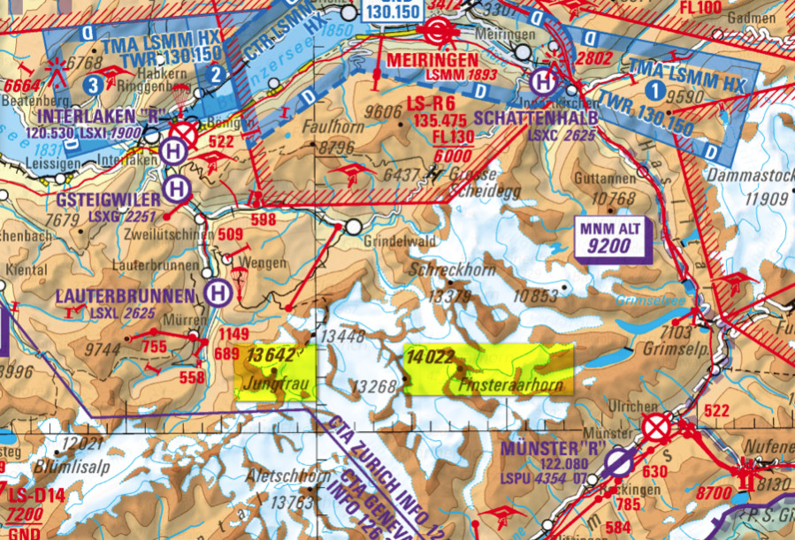
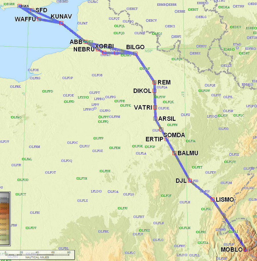
EGKA N0145F040 SFD VFR DCT KUNAV DCT ABB/N0151F090 DCT BILGO/N0151F090 IFR B3 VATRI G40 ARSIL B13 SOMDA A6 DJL A1 LISMO VFR MONIN DCT LISMO A1 DJL/N0151F090 IFR A6 SOMDA B13 ARSIL G40 VATRI B3 BILGO H20 XORBI H40 NEBRU/N0150F120 H40 ABB VFR N20 KUNAV DCT WAFFU EGKA
MONIN is the closest waypoint to Jungfrau.
950nm as filed.
Alternates: Biggin Hill EGKB for arrival (ILS), Lille LFQQ for a refuel on the way back
This shows the entire route, there and back. There is just a slight non-overlap in N France but that was purely to game the Eurocontrol validation. After around LISMO the flight was VFR and not subject to validation, but definitely subject to Swiss ATC practice on the day ![]()
So off I went, with a flask of Justine's mocha and enough camping gear in the aircraft to sleep on the North Pole. 2 oxygen cylinders, 2 1st stage regulators, 2 2nd stage O2D2 demand regulators. 2 layers of Merino wool thermal underwear in case of camping. Spare batteries. And four pee bottles ![]()
Departure weather was nice, if quite hazy
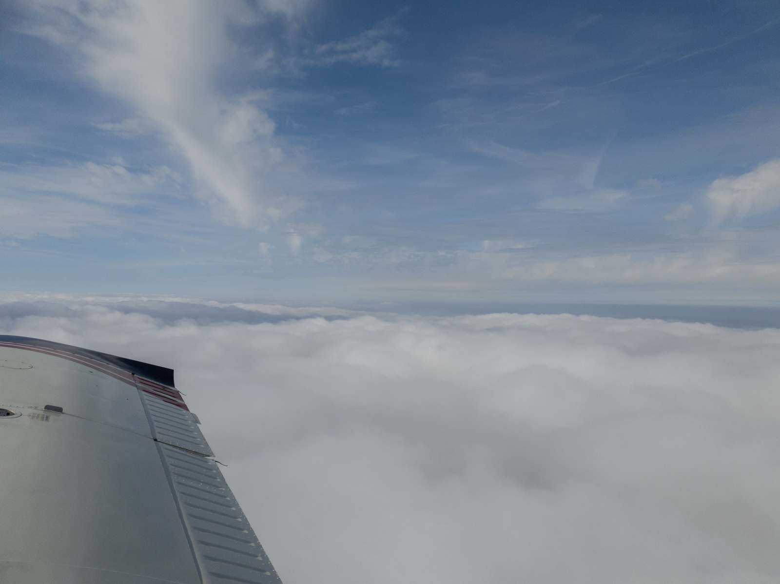
VMC on top very soon, and the entire flight remained in VMC except the UK portions. Cloud tops here are around 3000ft
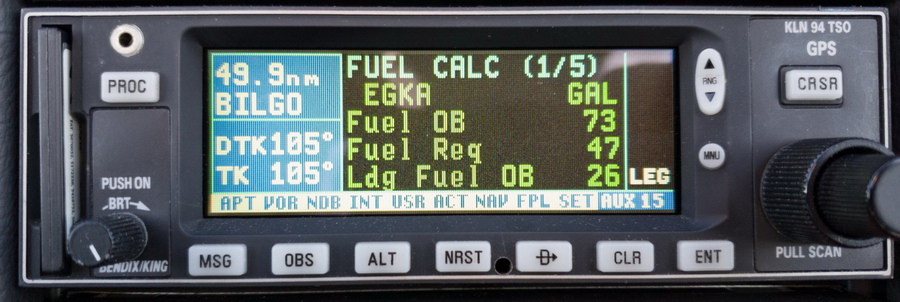
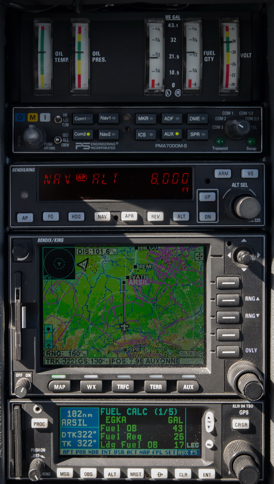
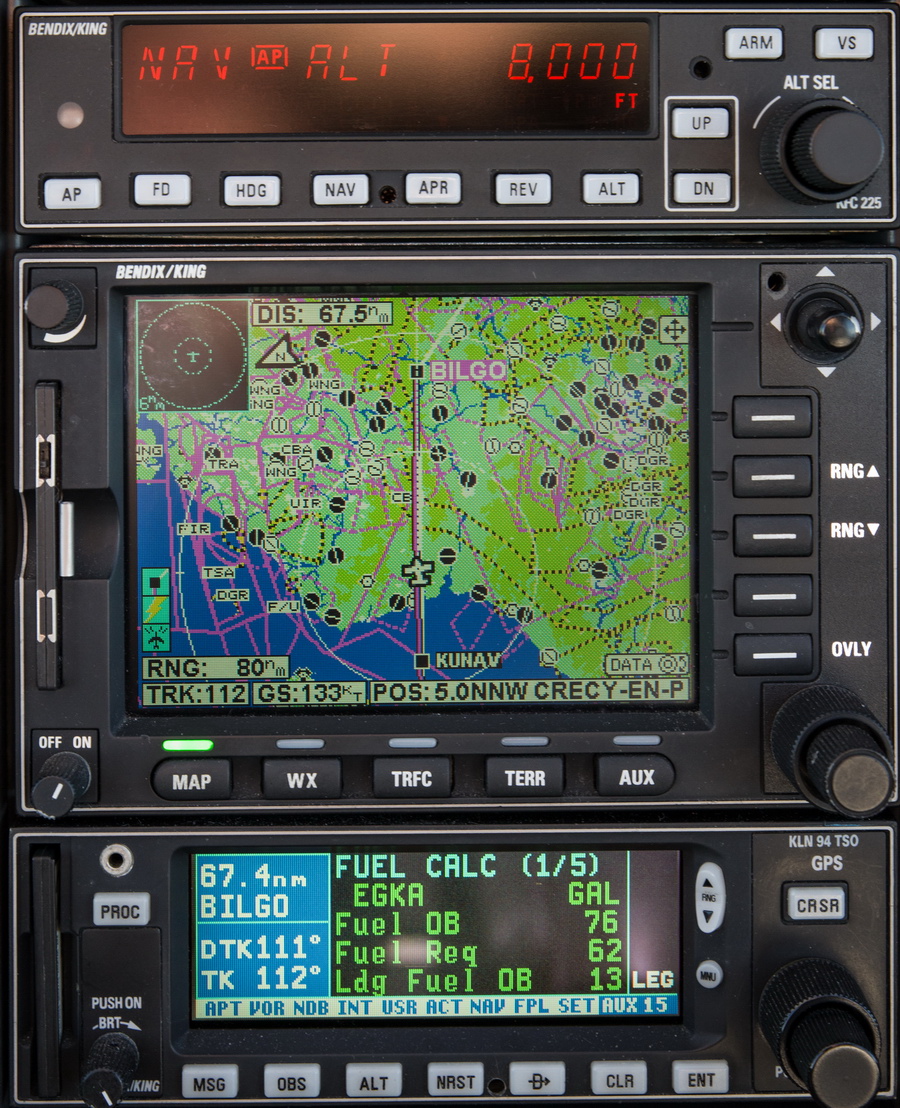
The computed LFOB (landing fuel on board) of 26 USG is reflecting the 13kt tailwind on the outbound leg, producing a good ground speed and thus the good fuel figure. A quick calculation indicated that if the winds hold up, more or less, I will land with about 15 USG
The name of the game is to fly high if there is tailwind and low if there is headwind. ASAP, I got onto Lille and got an IFR clearance (much sooner than the filed point) and a climb FL90, later FL110 and FL140 with Paris
Now at FL140 for the Alps. Further down, the tailwind dropped off, as predicted by the windy.com image. TAS was about 135kt, with the engine at 2200rpm and slightly LOP for the very best economy. No chance of a shortcut to JUNGF (my user waypoint) due to the French military areas permanently active; presumably expecting the USSR to invade and steal all the Sanofi vaccine ![]()
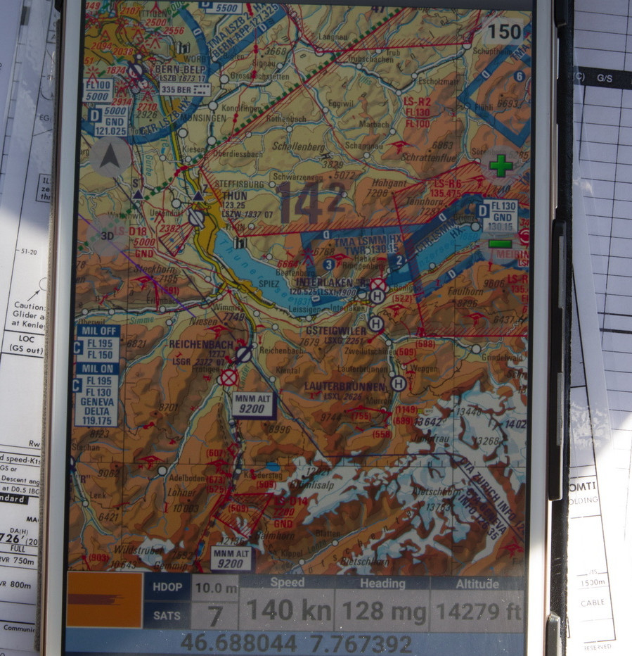
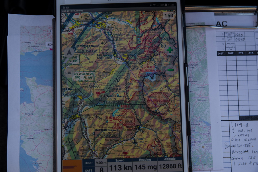
I had earlier programmed the user waypoint for Jungfrau but had this Swiss VFR chart running on the tablet just to make sure I found the other two in the planned sequence (Mönch and Eiger) and for an idea of nearby elevations
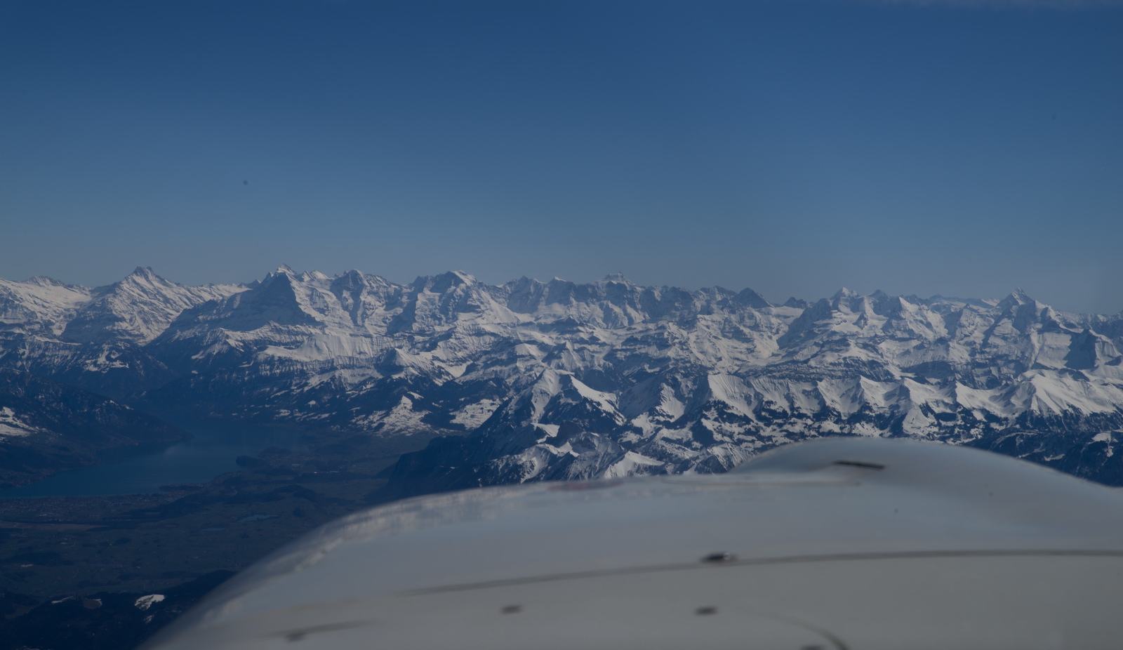
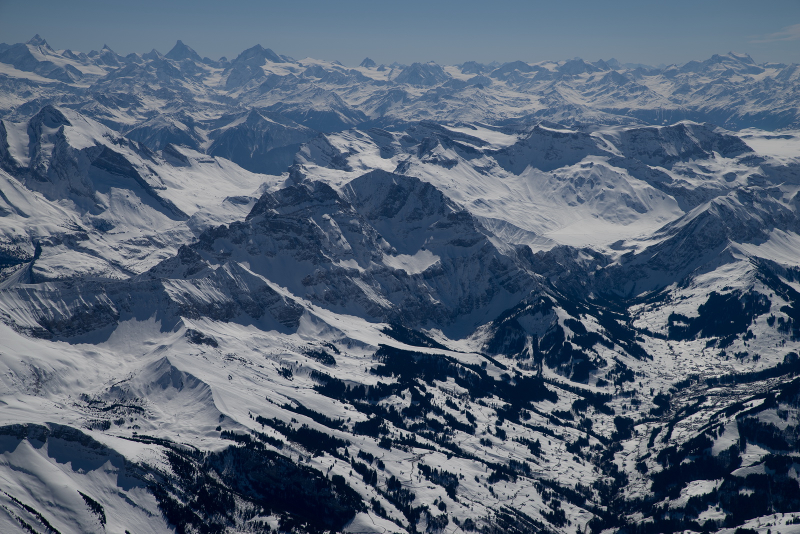
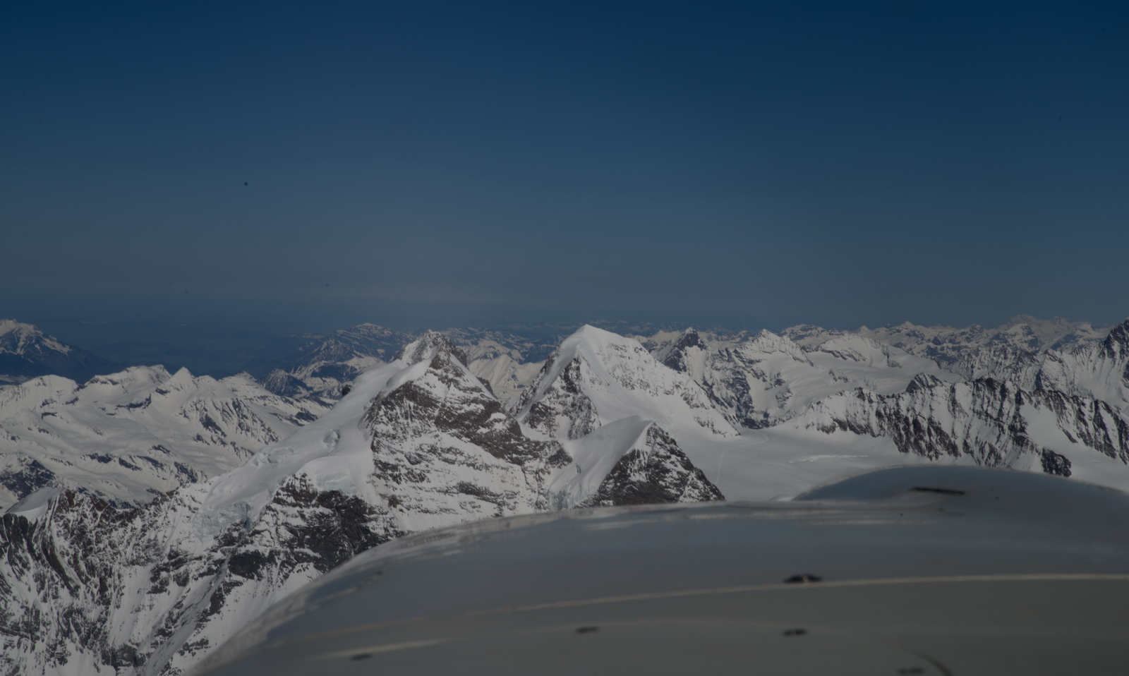
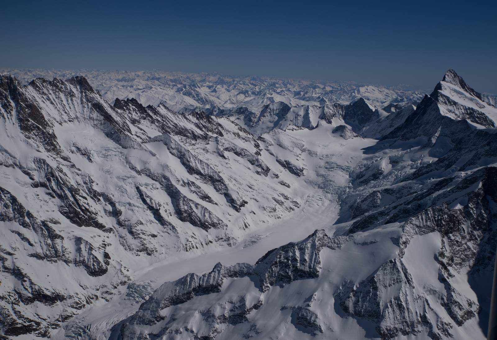
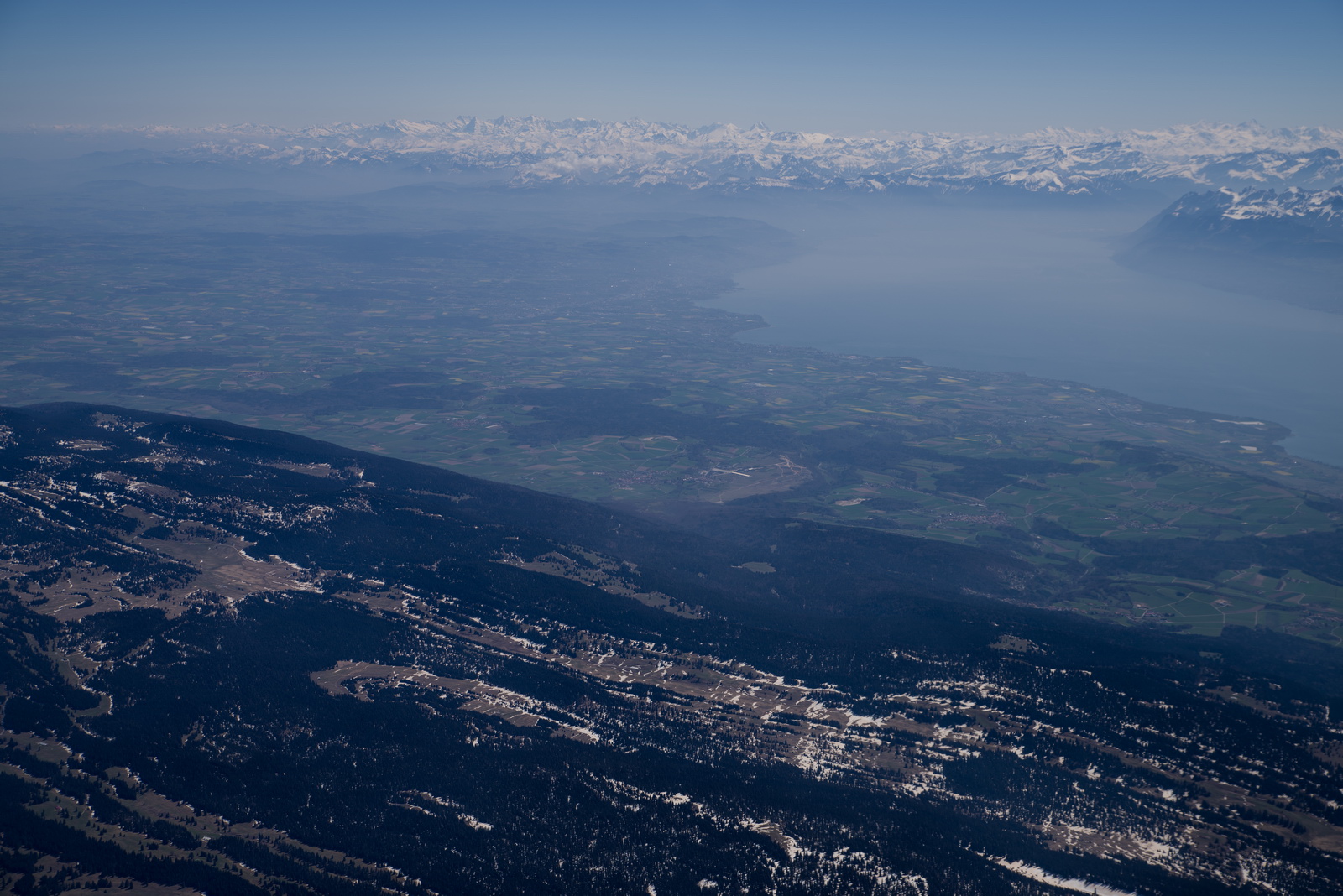
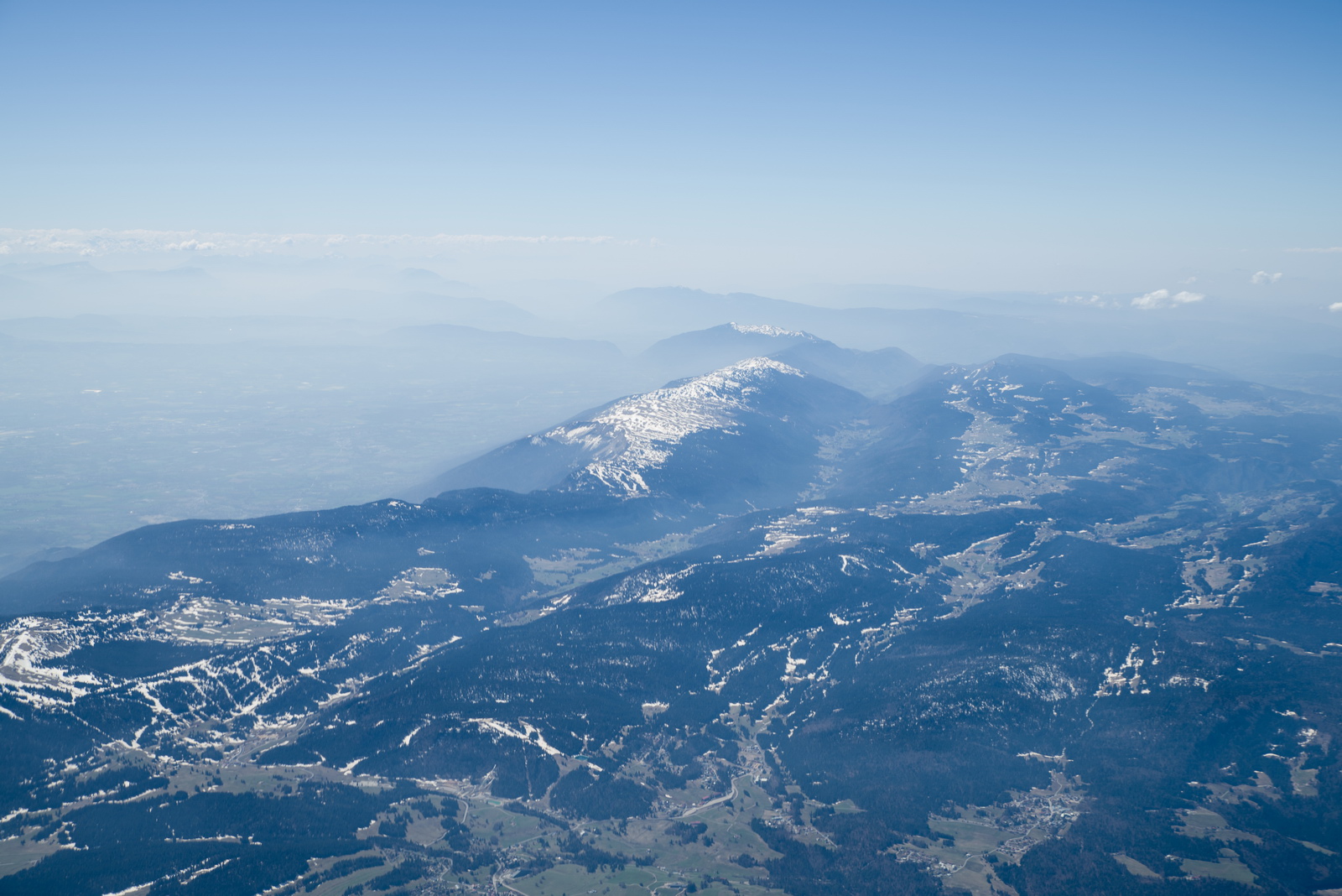
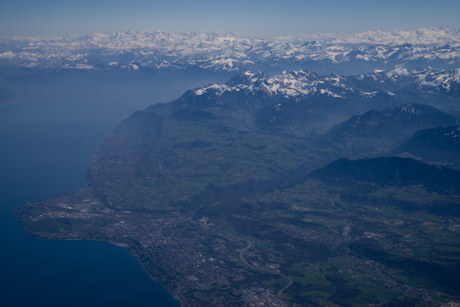
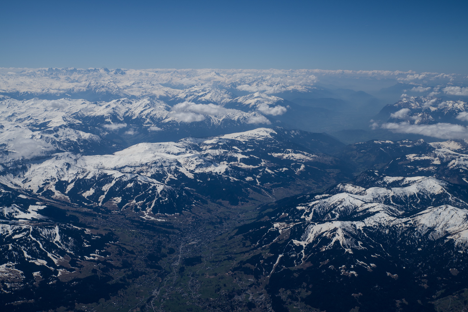
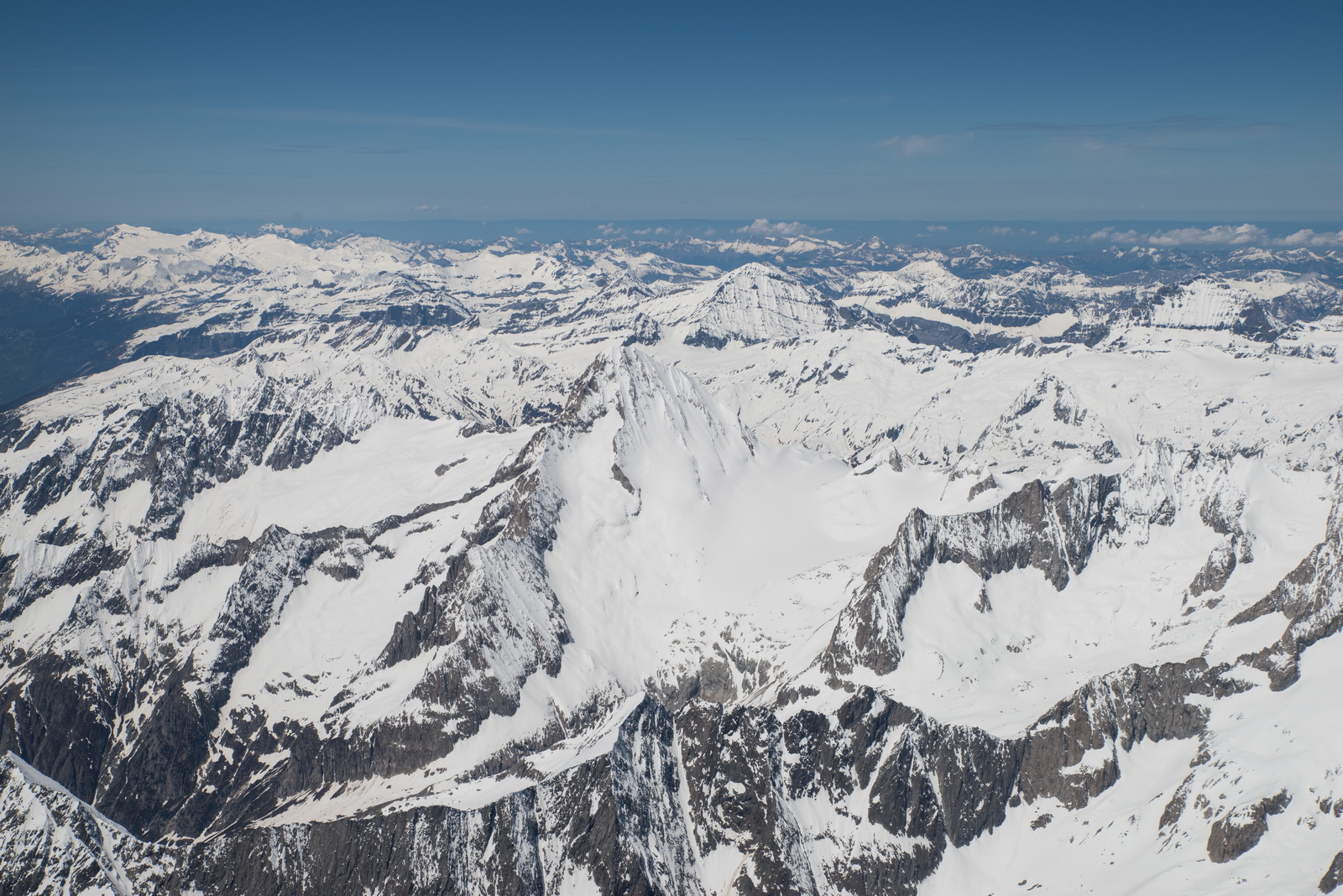
Approaching the Alps - always a wonderful sight


Here is gets even more interesting. Mountains are deceptive. They always seem higher than you are, especially if there is haze in the distance so you can't see behind them. Then when you get really close, their heights are as you would expect from the chart and from your GPS altitude
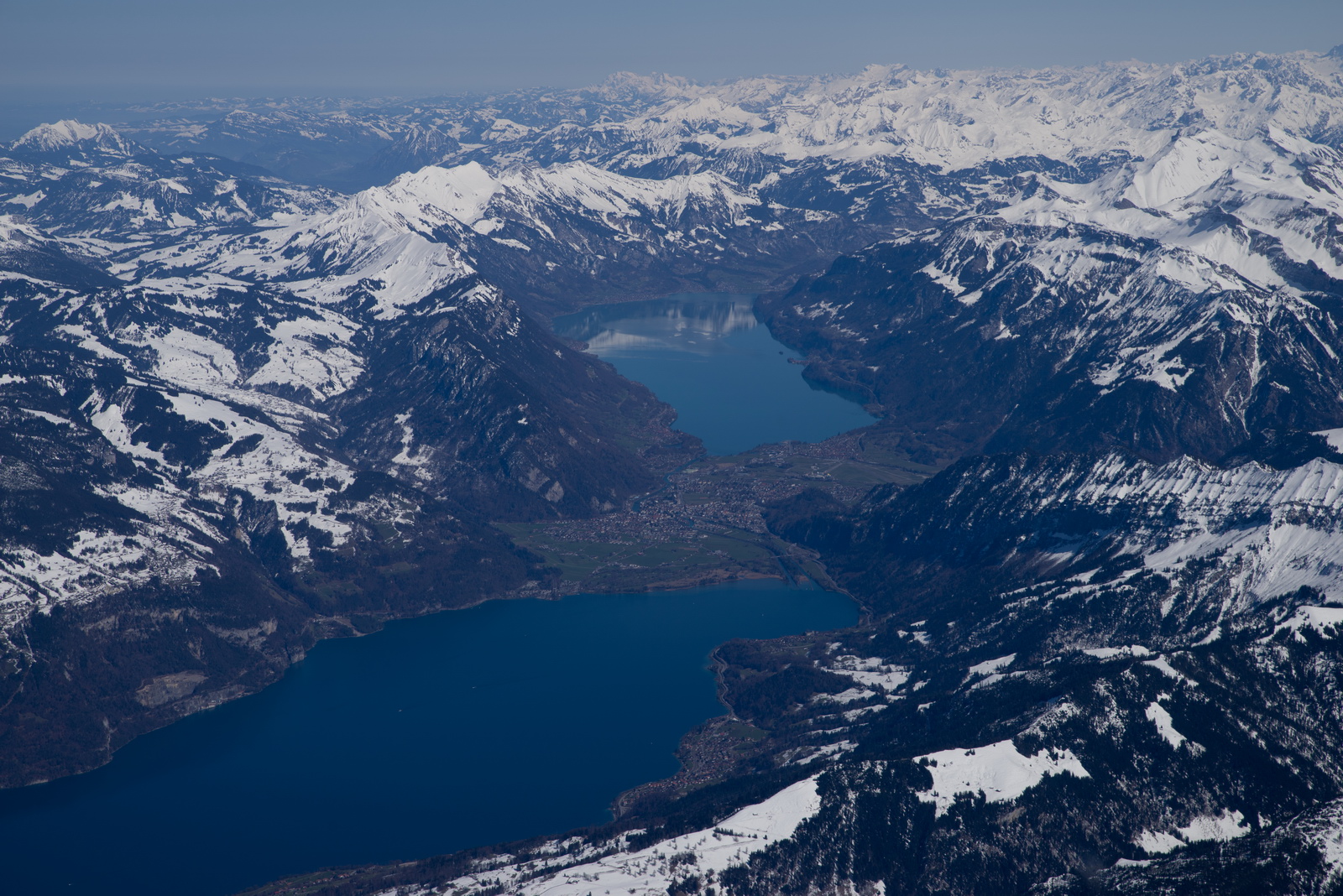
Interlaken
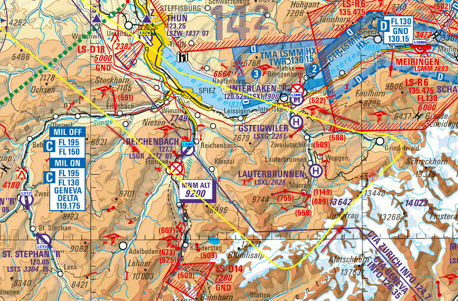
This map doesn't show Mönch and Eiger but they are roughly on a 045 degree bearing from Jungfrau, towards Grindelwald
We are now almost above Jungfrau (which is 1000ft below) and Mönch is straight ahead. These "through the propeller" photos are done with a proper DSLR camera (Pentax K1) with a slow shutter of 1/80 and around F22 to avoid over-exposure. The video (below) has good images of everything...
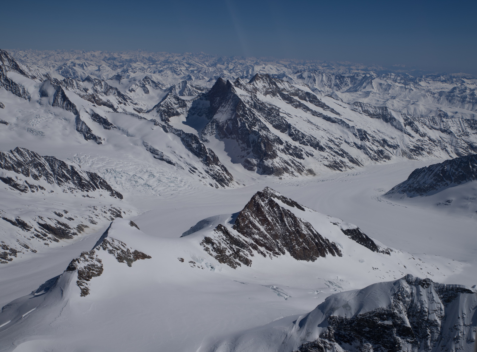
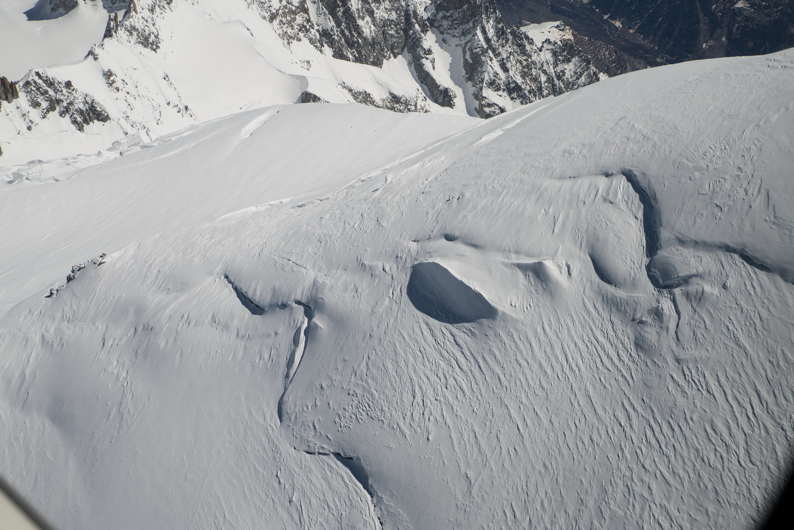
The glacier next to Jungfrau

At this point Swiss ATC, who earlier cleared me for anything below FL150, went ballistic and demanded a descent below FL130 due to an imminent military exercise. I replied I can't do it for a while due to the terrain being above that! They kept pressing me, so I started a slow descent (on autopilot, so I could take photos easily) to make it look like I was following orders ![]() I had checked Swiss notams before the flight, especially the military ones, so this was a bit of a mystery. But this happens in Switzerland...
I had checked Swiss notams before the flight, especially the military ones, so this was a bit of a mystery. But this happens in Switzerland...
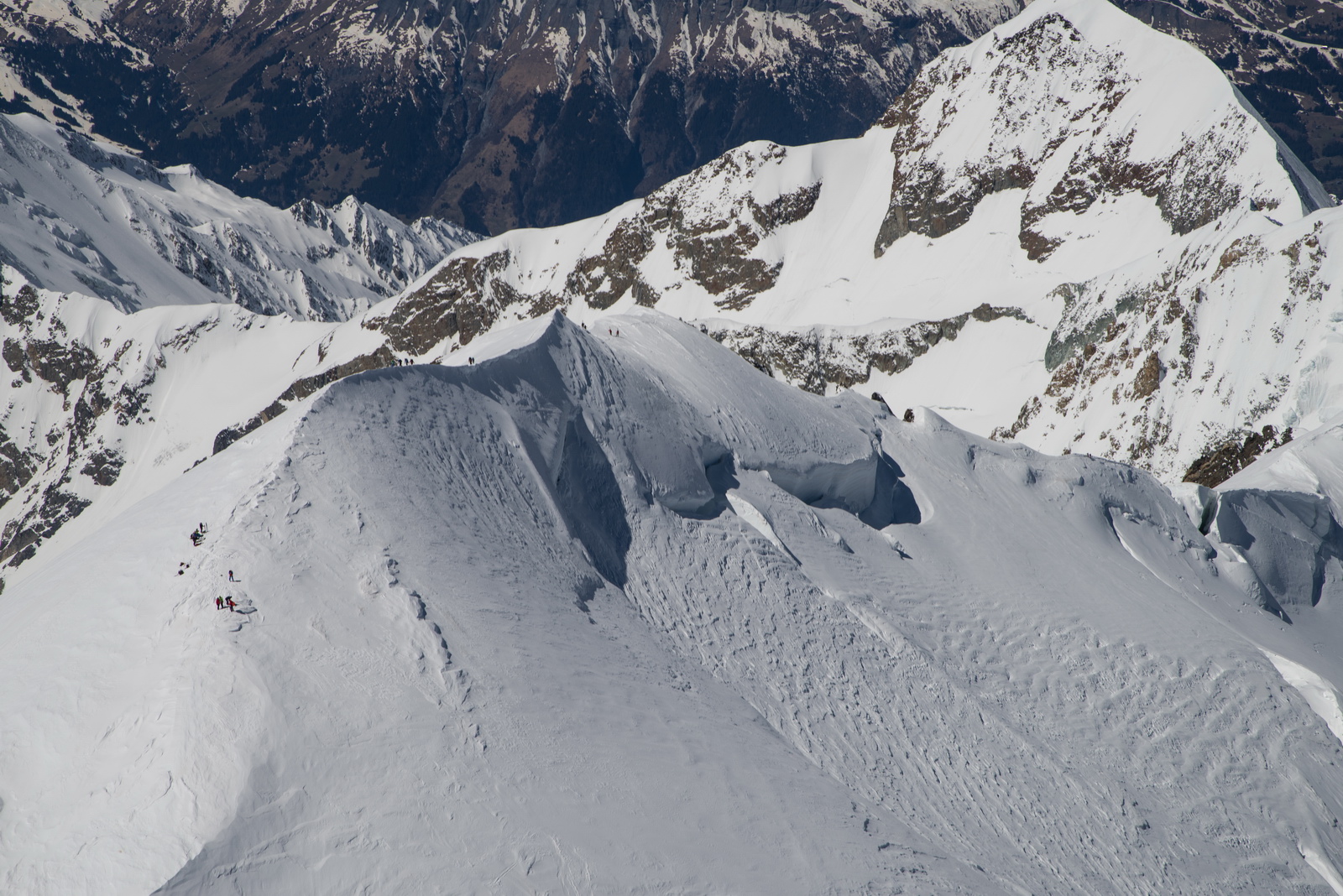
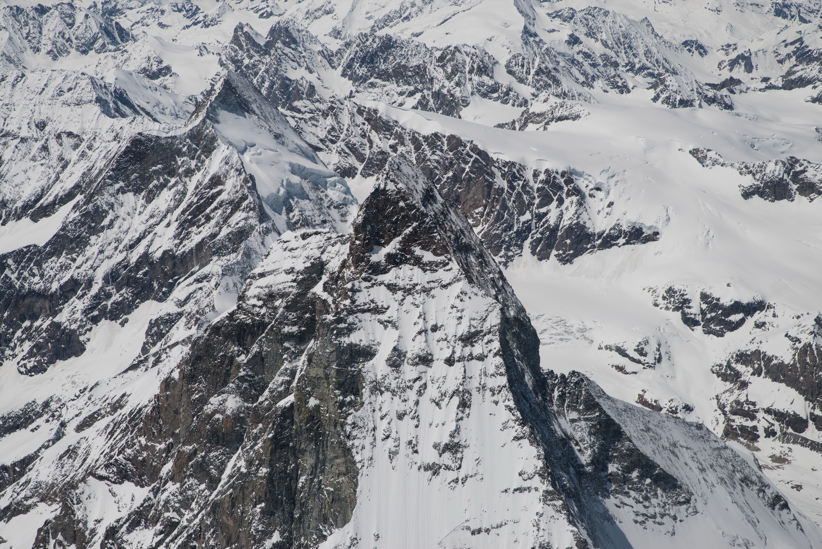
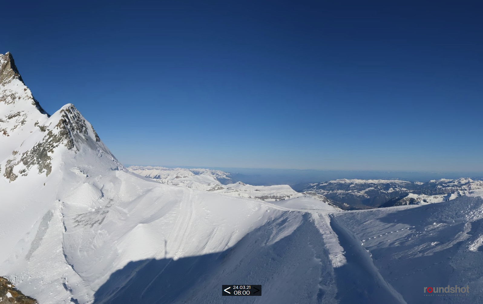
Finsteraarhorn – 14022 feet. I was just below that, at this point... probably, maybe…![]()

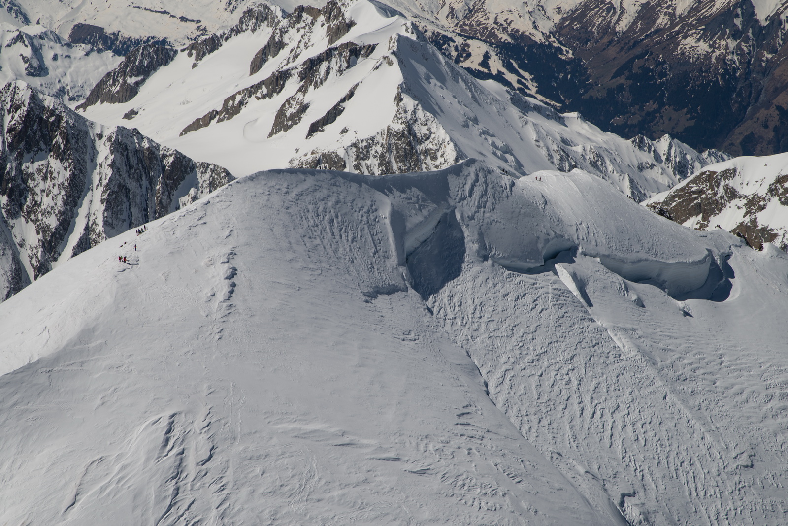
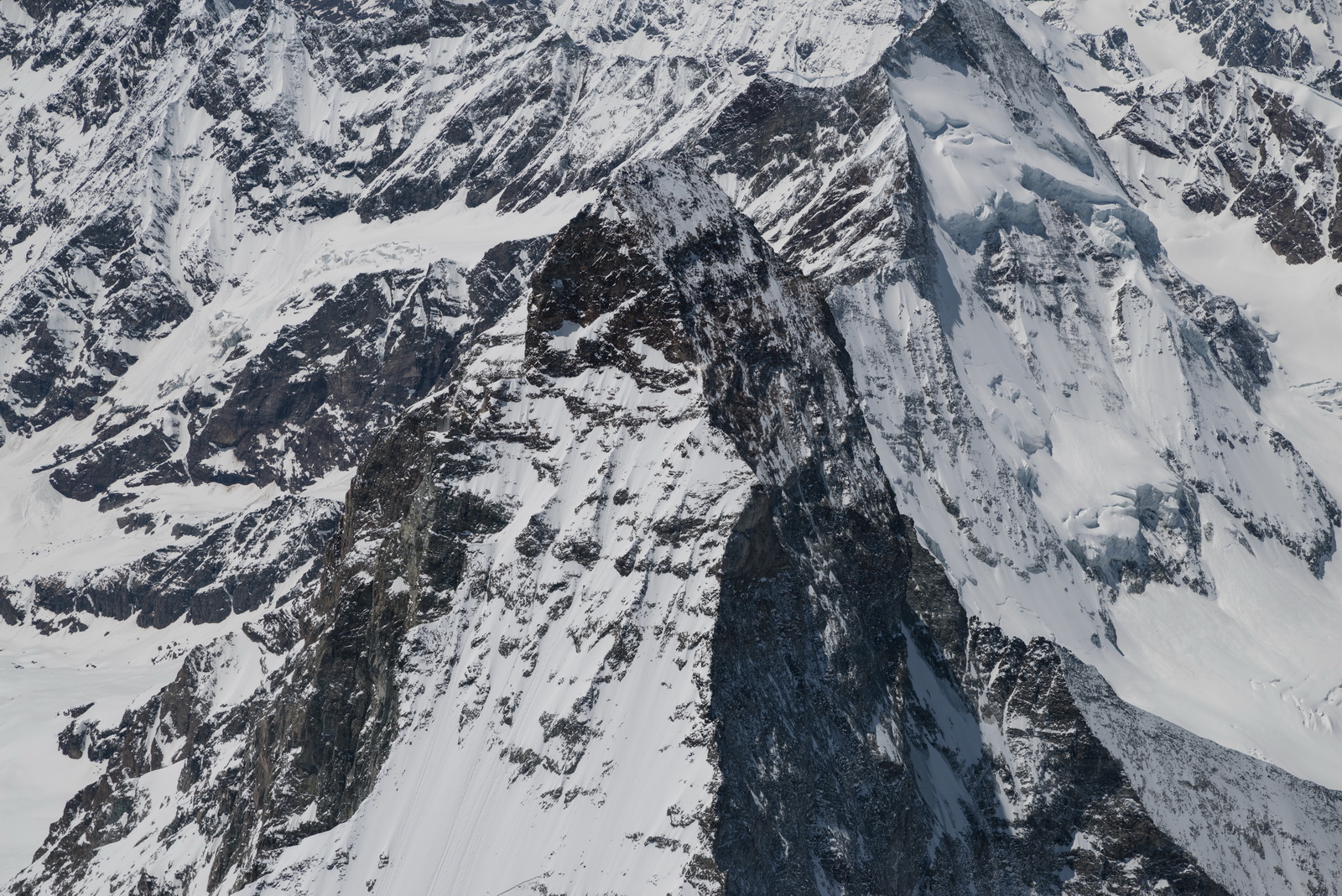
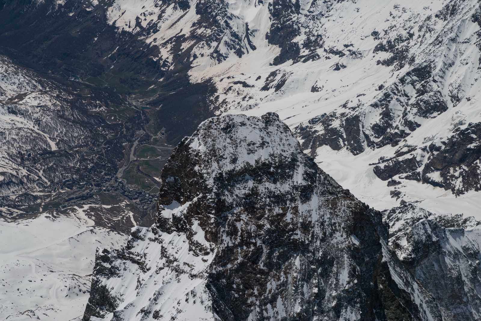
Having done Jungfrau and Mönch, I went over the Eiger and turned straight back to England. The Eiger was hard to find. In fact I was not sure I found it at all. It isn't an "obvious" mountain even when you are sitting at the Eiger Restaurant below it and from above even less so

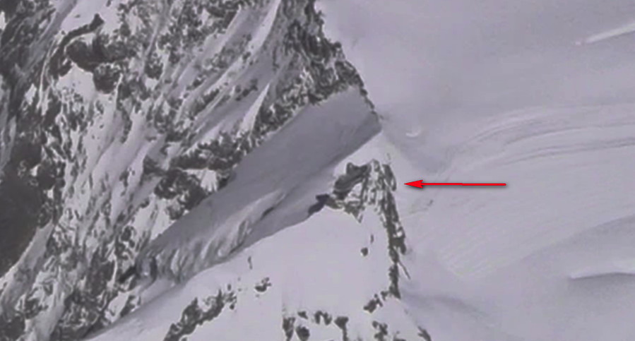
No photos were possible looking straight down but here are a few frames from the external camera. Mönch is immediately ahead in the next two, with the Eiger behind it. But I didn’t know this at the time; I thought the one ahead was Jungfrau.
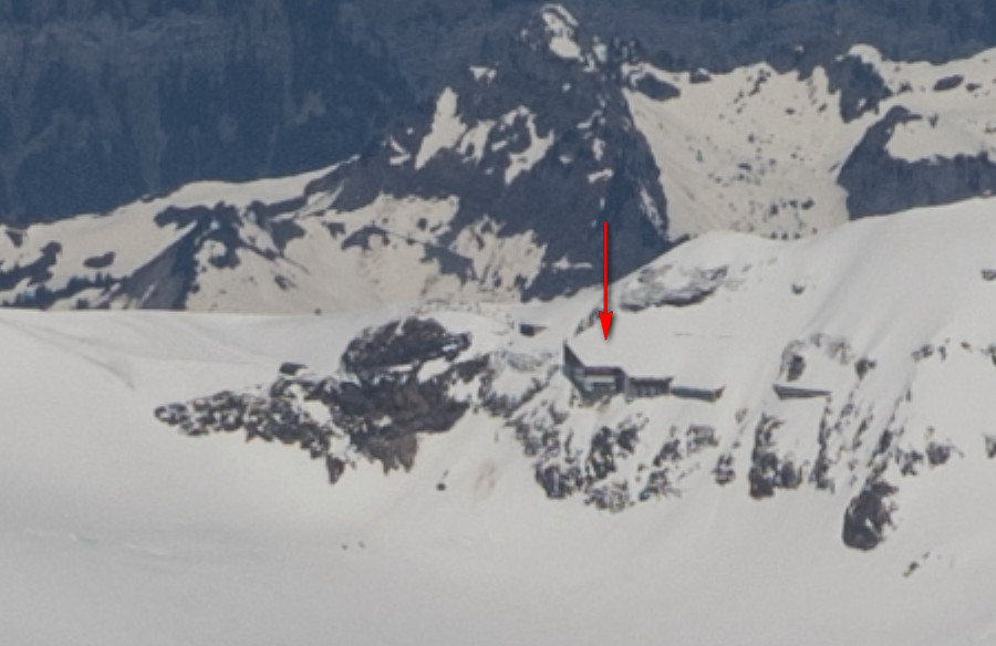
This - on a magnified frame from the video - shows the location of the Jungfraujoch restaurant - didn't spot it at the time and it is very hard to see it now
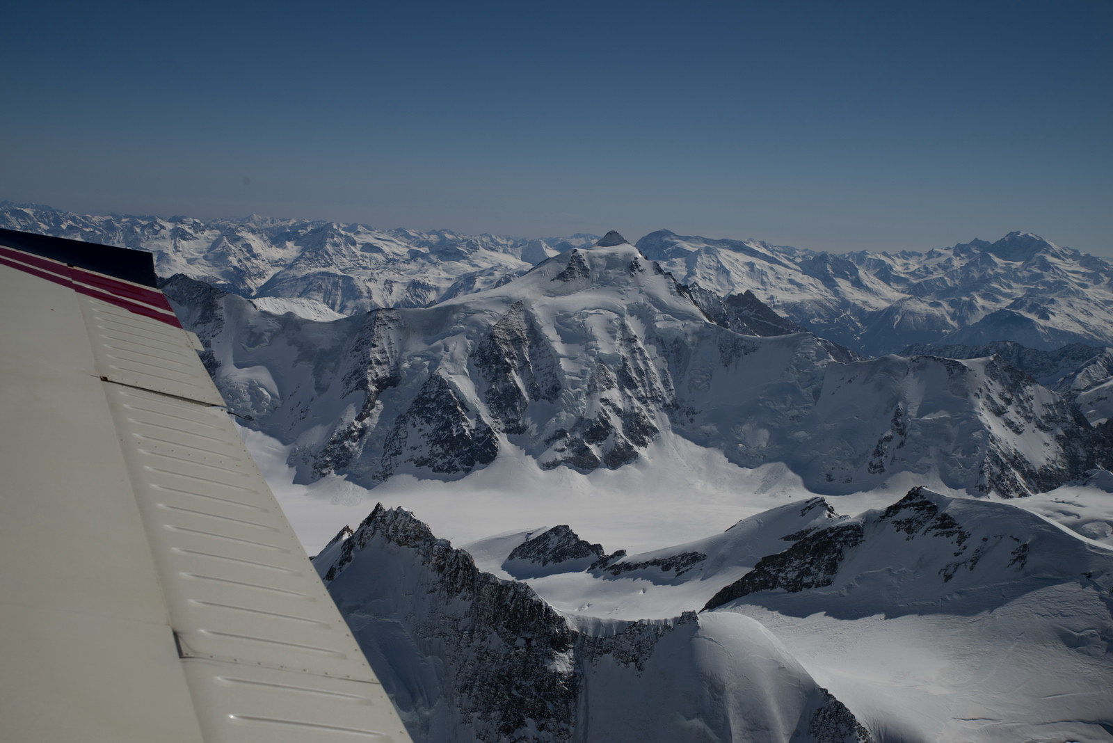
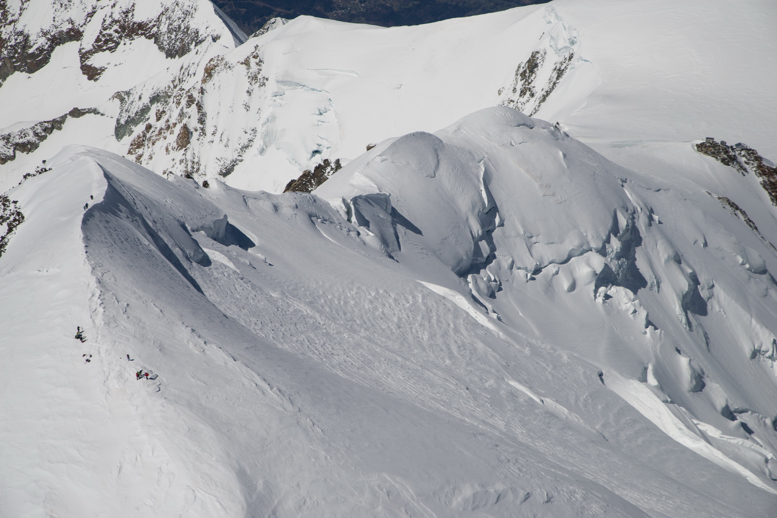
Here is a pic from the later Croatia flight
The Matterhorn was in the original plan but would have cost another ~8USG... It was left for the first flight to Croatia, May 2021.
Time for a late lunch ![]()
17 USG LFOB calculated - enough for about 1.5hrs' flying. At FL080 now, with headwind, and in any headwind it usually pays to fly lower
I tried to get a good DCT from the mountains but I was still VFR then and Swiss just warned me about a French mil area across the border – LFR158A – which I could not immediately find on the chart, so I asked them for a vector and an IFR clearance, and the result was a dogleg a long way to the west... another lesson re-learnt many times (if you cancel IFR, do it only for as long as absolutely necessary).
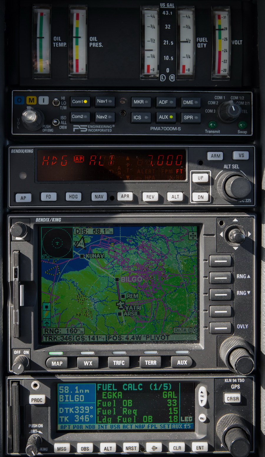
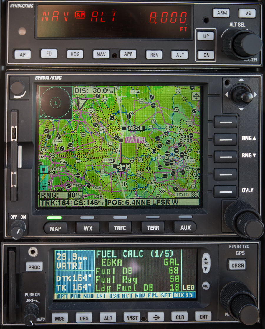
Headwind turned out as forecast; now down to FL070 but the headwind didn’t drop as much as windy.com forecast (it rarely does). LFOB 18 USG and actually we have a little tailwind here. To the left is the Paris TMA and a shortcut VATRI-KUNAV is impossible to get
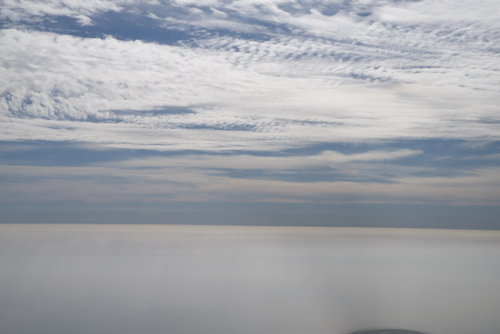
You know then you are approaching England because the cloud reappears ![]()

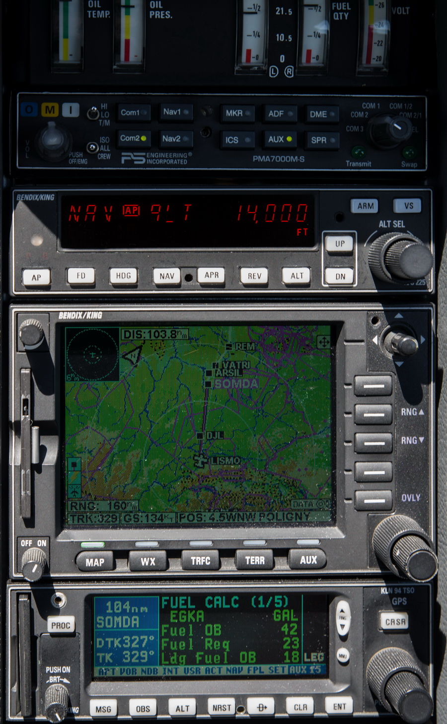
Nearly home. I had been getting wx continuously along the flight, both using the telegram Autorouter bot (on 4G – available very intermittently) and using the Golze ADL satellite system which is 100% reliable. The telegram bots often get “jammed up” if you ask for an image which it can not download in one go and then you can't use it for tafs/metars, but the ADL is reliable. I also have the new EuroGA database telegram bot which can be used for weather and notams in the same way.
23kt headwind now, with LFOB showing 16USG, but we are nearly home. IFR was never formally cancelled even though the flight plan called out for that; no need to since I got the direct route I wanted (this bit usually works) and France doesn't care whether you are VFR or IFR if you are heading out of their airspace ![]() Using the standard strategy for long flights, I ran down the left tank to the LOW warning light (which comes on at 8 USG in that tank) plus another 20 mins, which would leave me with about 4 USG in that tank, switching to the nearly half full right tank at the N French coast
Using the standard strategy for long flights, I ran down the left tank to the LOW warning light (which comes on at 8 USG in that tank) plus another 20 mins, which would leave me with about 4 USG in that tank, switching to the nearly half full right tank at the N French coast
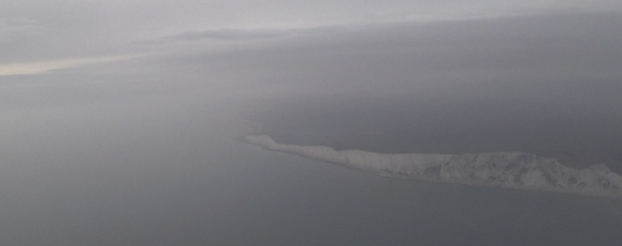
The UK wx forecast turned out to be similar to what was expected - mucky. The cliffs at Seaford
A visual circuit and a tight left base before it got worse ![]()
With the wx issue at the end of the flight, it was wonderful to be back on the ground and not have to divert to Biggin Hill, with the hassle of getting a taxi back and again later to retrieve the aircraft - a £200 exercise.
Airborne time 6:50. Landed with 15.3 USG which is about 1.5hrs' flying time. I have done longer flights but not much. The lowest I have ever landed with was 12 USG.
I expected massive police presence because they had been meeting up every single GA flight which went outside UK airspace - some people have been flying practice approaches in France. But there was nobody... I am sure the reason was that they saw EGKA as the start and EGKA as the end (on the flight plan) and since they have no way to plot a filed flight plan route (who has?) they probably never realised I was going so far out of the UK.
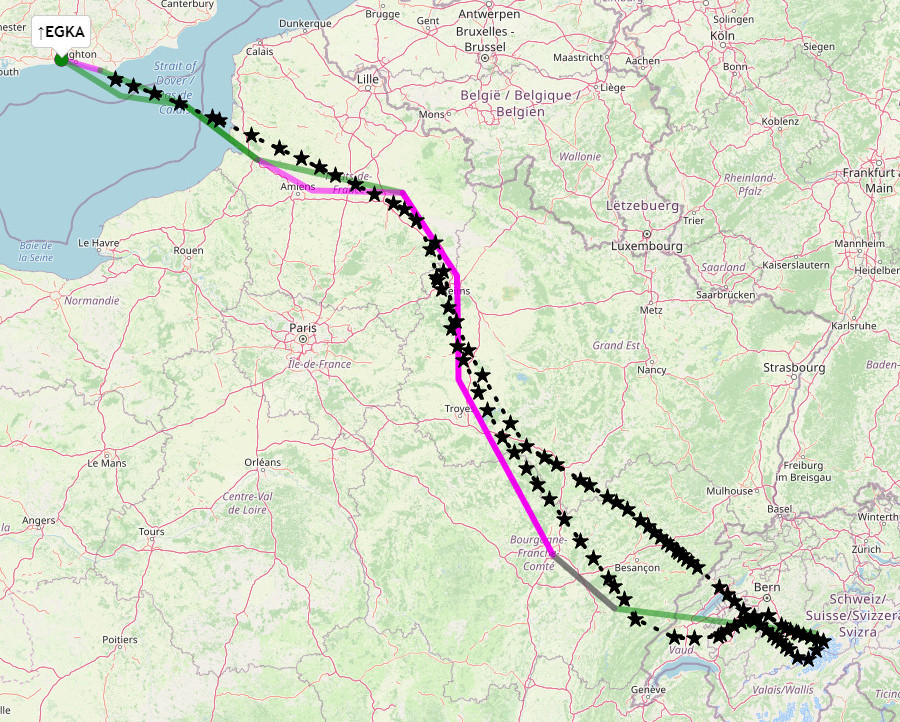
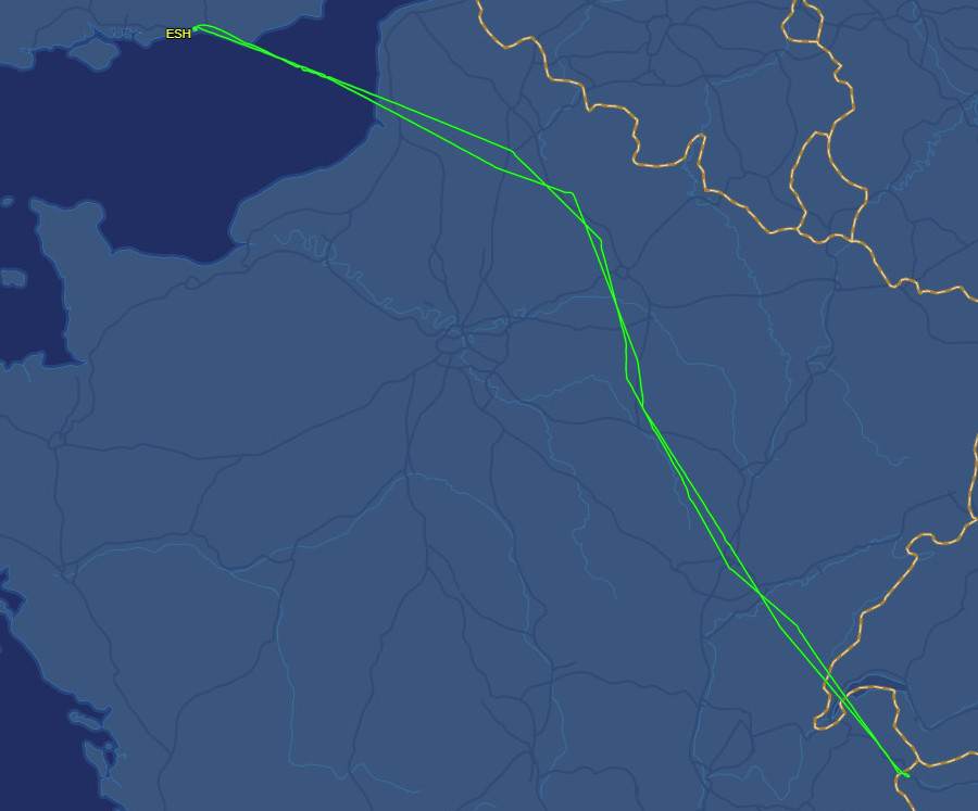
The route actually flown (Eurocontrol tracking - not always available) is shown in black. Green is filed VFR, magenta is filed IFR:
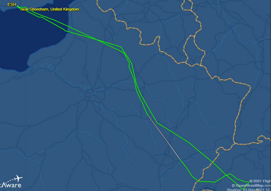
and this is the Flightaware actual track flown
and here is the actual track flown over the mountains, in yellow
This is a video containing the entire flight and the ATC audio. It was edited to be as useful as possible to pilots working towards the instrument rating:
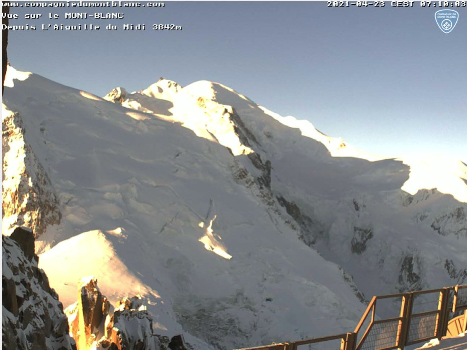
Trip #2 - Shoreham to the Alps - Mt Blanc - April 2021
The flight planning and other constraints for this flight were similar to the #1 trip. The coronavirus climate was also very similar, with a very slight improvement. Some background is here.
The other weather sources showed a good day: 1200 MSLP Mt Blanc webcam IR image 1000 wind 1600 wind TAFs and METARs
The TAFs showed a really great CAVOK day. In fact the decision to go was made only the day before; I had almost given up due to bad wx everywhere. The wind showed a significant change during the day but not enough to be a problem.
In the route below, the start is IFR, the FL040 is just garbage to satisfy the validation system, the level changes are meaningless, MOBLO is near Mt Blanc and handy for ATC who may not know where Mt Blanc is, and the other VFR sections are to shorten the route to save fuel. In particular I departed VFR from Shoreham, 5000ft across the Channel, avoiding London Control who would send me to TRACA which is way to the east, and called up Lille direct. Initially I flew low (5000ft) due to the headwind and controlled airspace base, later FL080 for most of the southbound bit, but much later climbed FL160 for the Alps.
EGKA SFD/N0145F040 VFR DCT KUNAV DCT ABB/N0151F140 DCT BILGO/N0151F140 IFR B3 VATRI G40 ARSIL B13 SOMDA A6 DJL A1 LISMO VFR DCT MOBLO DCT LISMO IFR A1 DJL/N0151F090 A6 SOMDA B13 ARSIL G40 VATRI B3 BILGO H20 XORBI H40 NEBRU/N0150F120 H40 ABB VFR N20 KUNAV DCT WAFFU IFR EGKA
MOBLO is the closest waypoint to Mt Blanc.
822nm as filed.
Alternates: Biggin Hill EGKB for arrival (ILS), Lille LFQQ for a refuel on the way back
This shows the entire route, there and back. There is just a slight non-overlap in N France but that was again purely to game the Eurocontrol validation. The LISMO-MOBLO-LISMO section was VFR and not subject to validation, but definitely subject to Swiss ATC practice on the day ![]()
For reasons unknown, not only the Autorouter could not develop the route (same for the #1 flight above) but even with manual hacking it would not validate even though it validated in other validation tools. So the route was filed via EuroFPL which is my normal backup for IFR flights, and my primary tool for VFR flight plans.
There was actually a mistake in the flight plan altitudes: you cannot fly above FL115 in a large piece of NE France. They call it the "Paris Area" but it is a lot bigger. Basically it is the whole ABB-DJL portion above. This wasn't a problem on the actual flight, and doesn't explain why the Autorouter was reporting some strange error, while EuroFPL got it validated fine.
Shoreham now had longer opening hours – back to normal: 8am to 8pm local. This offered more options if one had to stop somewhere. Again, Lille - the emergency fuel stop - was contacted and it was carefully verified that one could do a refuel without any coronavirus tests or quarantine being imposed, and that there would be assistance with the avgas pump. And Biggin Hill was again telephoned to make sure there were no issues.
The aircraft was left out overnight so I could do an early start; around 8:30 (there is a runway inspection etc). Tanks filled up the brim - as I nearly always do. The airborne time was forecast at 6hrs+ but if I had to refuel in France, and something went wrong there (e.g. the fuel man being out to lunch for 3 hrs) then I would need all the time I could get, since an overnight stay would definitely get UK police attention, trapping me into a quarantine. I carried the full tent kit mentioned earlier (and nowadays that lives permanently in the aircraft because it weighs only a few kg) with extra Merino wool layers due to freezing temps at night but even sleeping next to the aircraft (which 99% of airports won’t allow anyway, airside) would not avoid a UK quarantine. The only thing I forgot to bring was my liquid fuel stove (which can burn avgas, jet-A1, etc ![]() ) but it is useless anyway unless you bring or can get food to cook. I also carried an FFP3 mask in case one had to go somewhere in a taxi or a bus. At this point in time I had only the first vaccination...
) but it is useless anyway unless you bring or can get food to cook. I also carried an FFP3 mask in case one had to go somewhere in a taxi or a bus. At this point in time I had only the first vaccination...
Perfect wx for the departure

LFOB (landing fuel on board) showing 13USG. On the #1 flight (above) the “zero wind” figure was about 15, but on that one the winds pretty well cancelled out. On this one I was expecting about 20. So the 7USG shortfall is due to the headwind of about 15kt. In fact the initial LFOB figure was 8 USG due to strong winds over the UK. As previously, the flight was done mostly at 2200rpm which produces the best economy, while offering a reasonable altitude capability
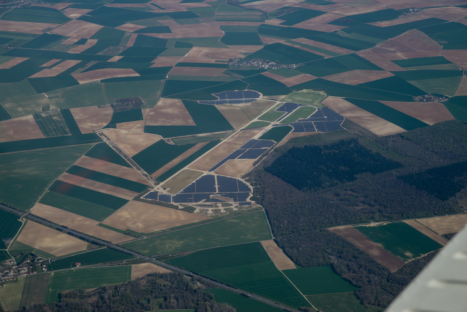
One of many mil or ex mil airports around France, with the parking pads, awaiting the USSR (or British?) invasion ![]()
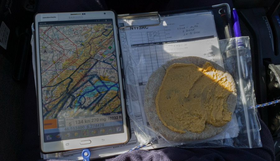
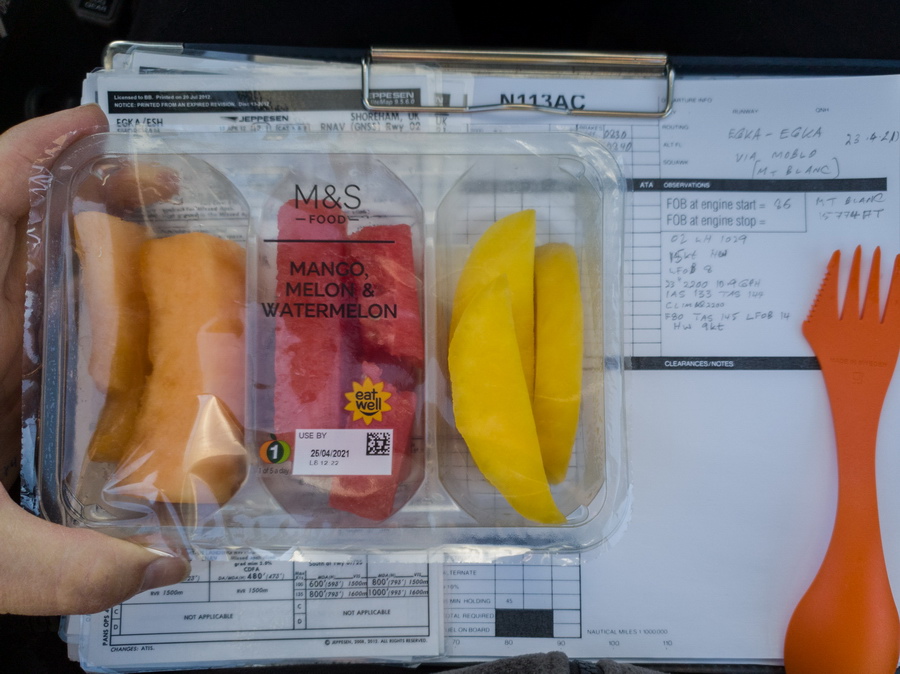
High quality in-flight catering ![]()
A much improved LFOB halfway down France, with around zero wind, and the 18USG turned out to be an accurate prediction
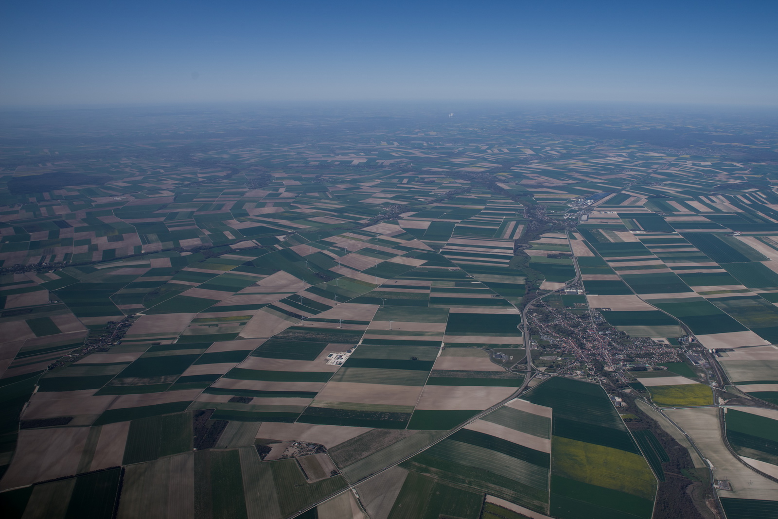
This is what most of N France looks like from the air. An autopilot, and coffee, are mandatory ![]()
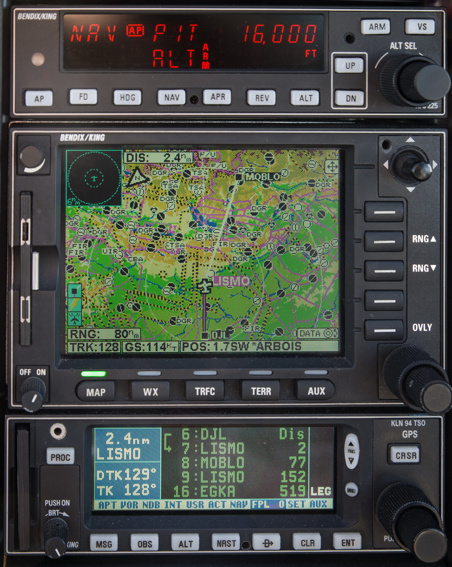
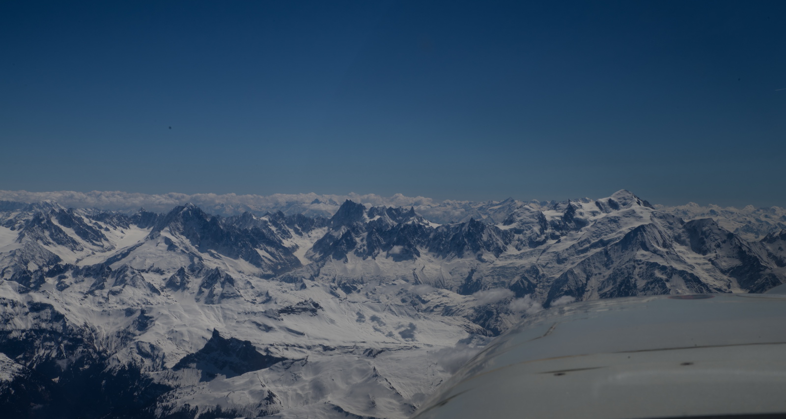
Near the Alps, climbing (in PIT mode; the best way to reach higher altitudes) to FL160, and it will be time to cancel IFR soon, but best to to it as late as possible because once VFR, ATC are not obliged to look after you for DA, R, P zone avoidance. But on this occassion Swiss ATC were outstanding (they are usually very good, except when they aren't ![]() ) and confirmed “everything is coordinated”. Of course I was recording the cockpit audio
) and confirmed “everything is coordinated”. Of course I was recording the cockpit audio ![]() along with the video. And the tablet records the GPS track. The video and audio are synced by starting both at the same time (not good enough for lip sync but I don’t film myself). ATC asked me to not deviate to the right of the track, due to traffic, initially. Mt Blanc is slightly left of MOBLO
along with the video. And the tablet records the GPS track. The video and audio are synced by starting both at the same time (not good enough for lip sync but I don’t film myself). ATC asked me to not deviate to the right of the track, due to traffic, initially. Mt Blanc is slightly left of MOBLO
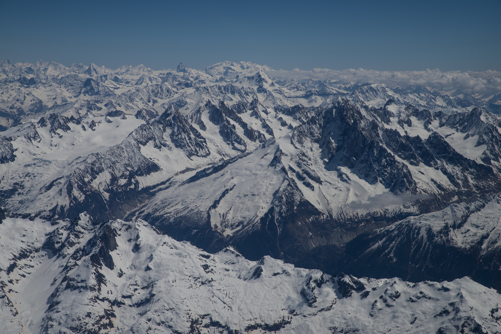
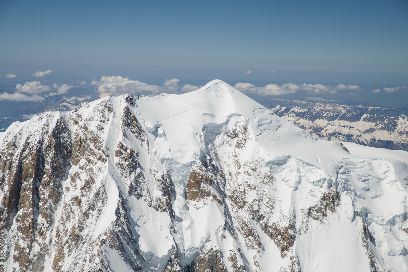
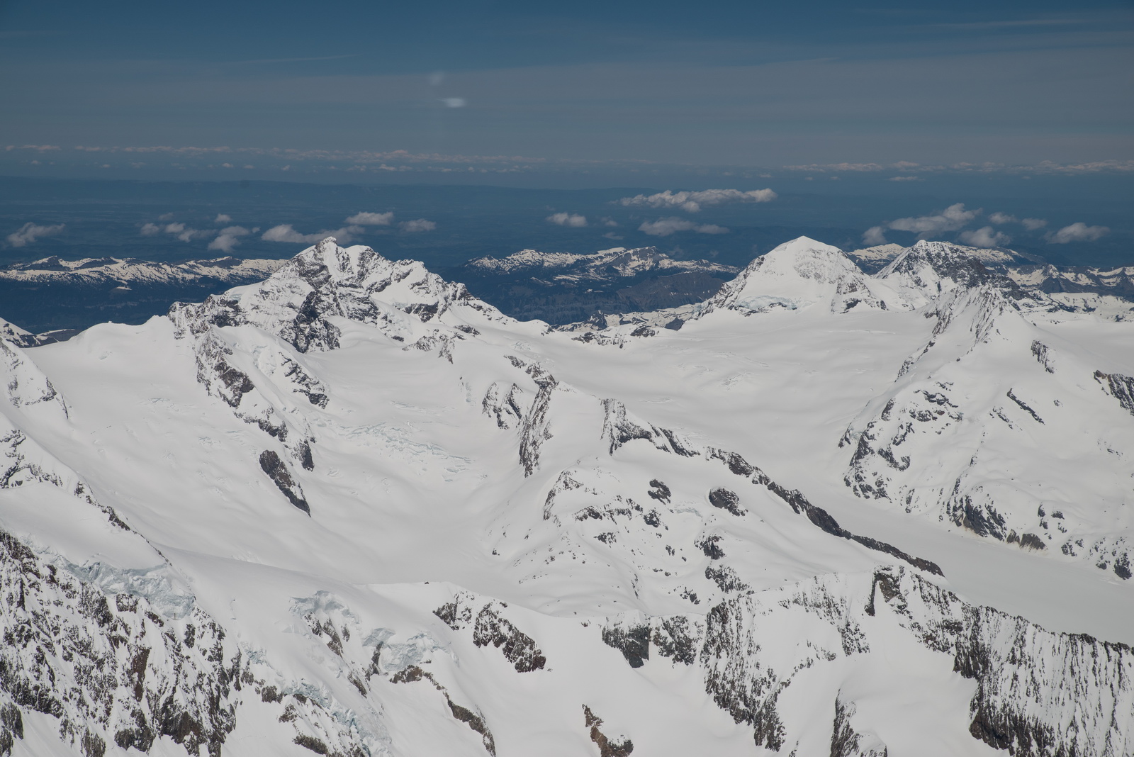
Mt Blanc can be seen straight ahead

The GPS map was used to get the precise track to the summit, with some crosswind around
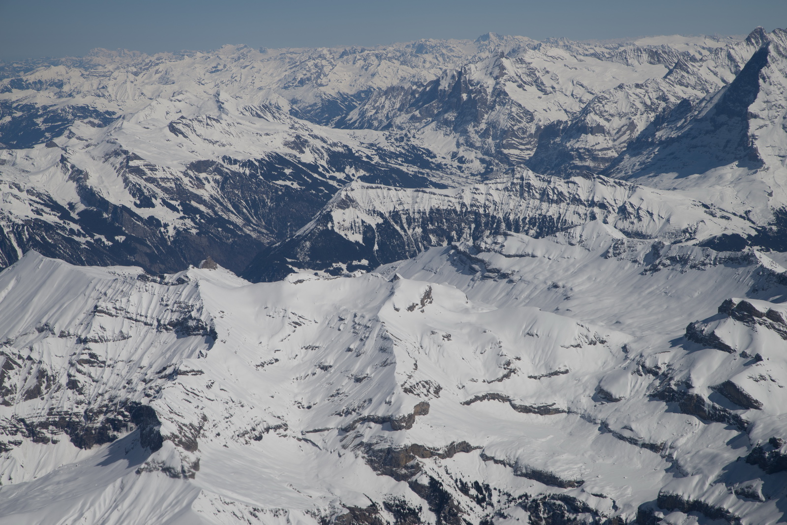
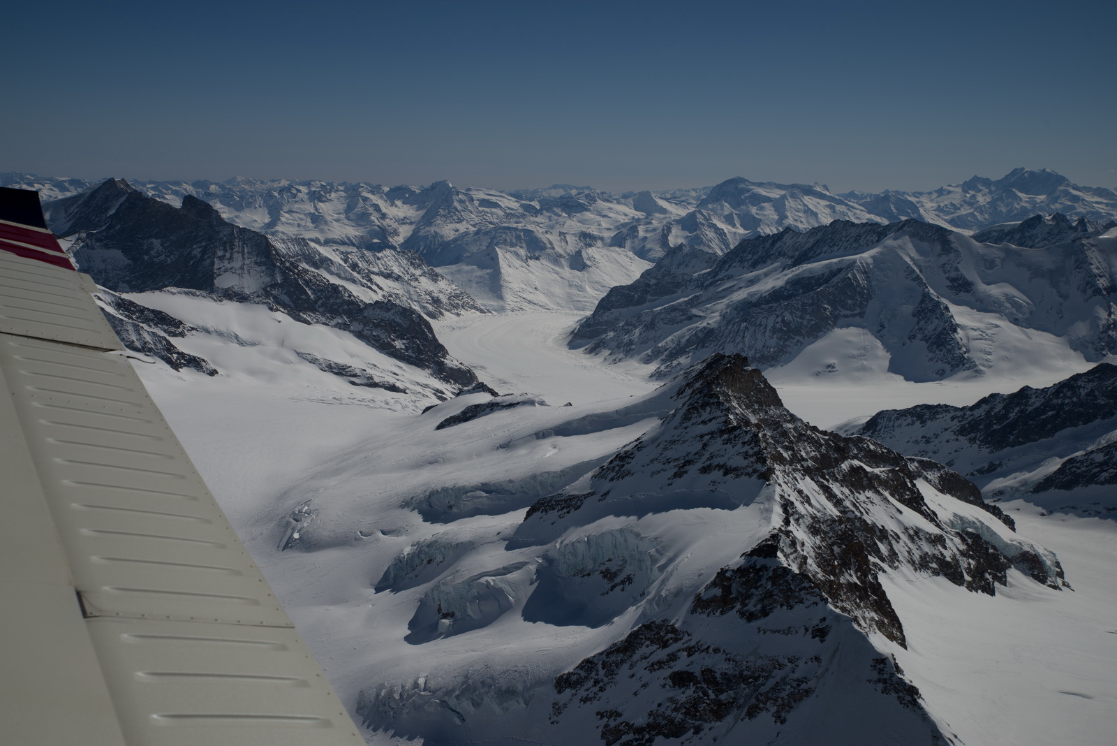
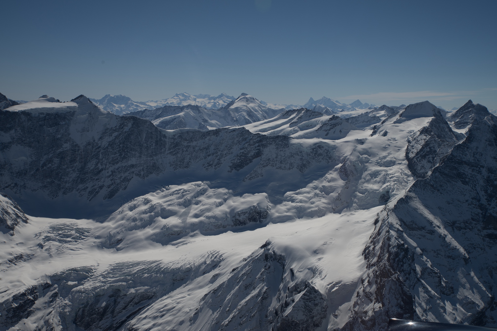
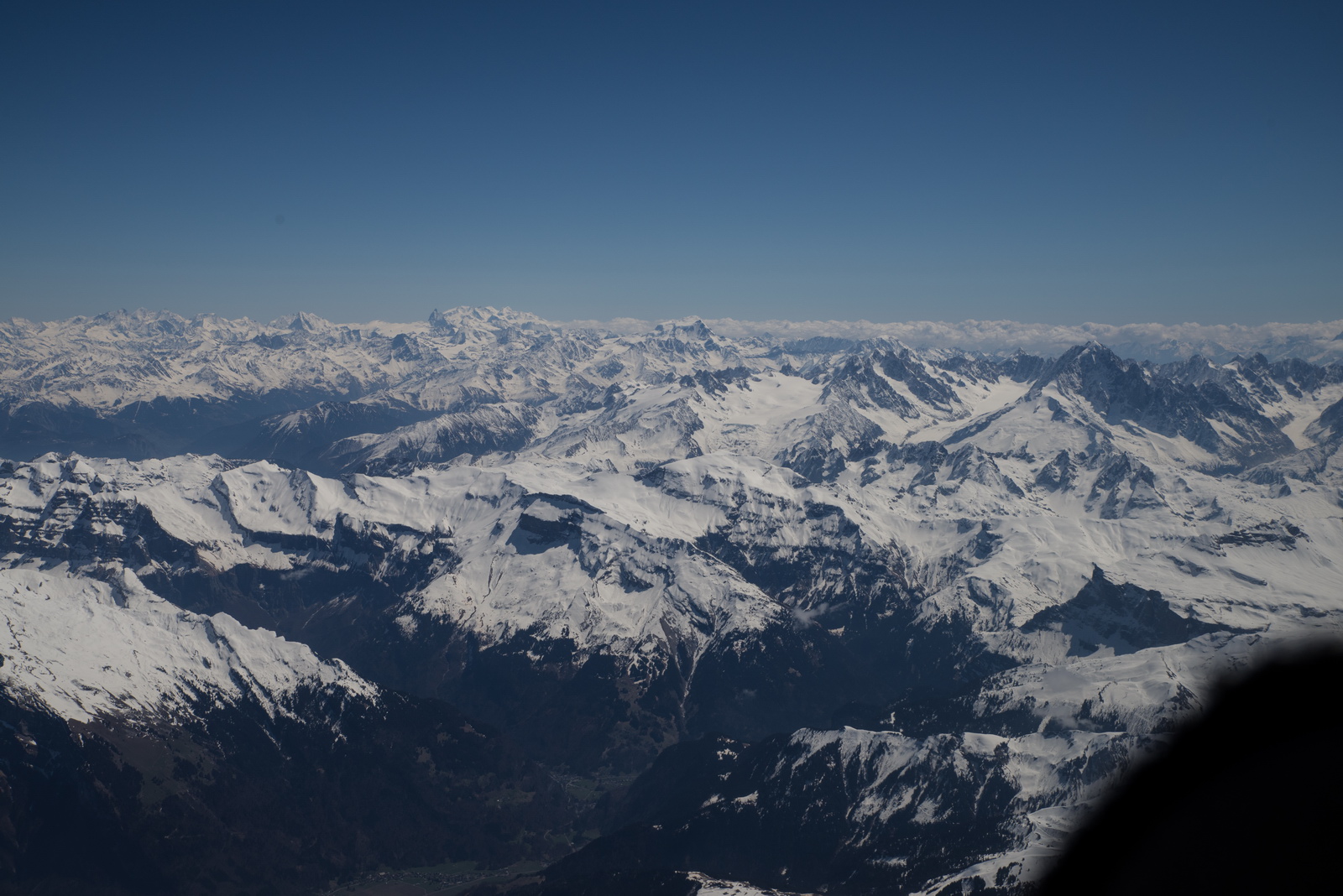
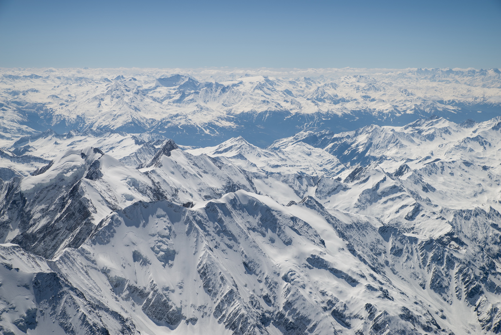
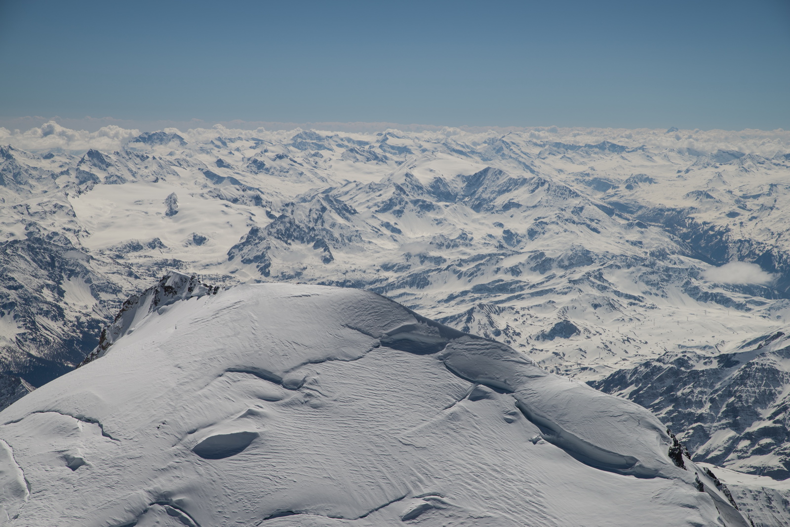
Much of the snow seen a month ago on the Jungfrau flight has melted

Straight ahead!
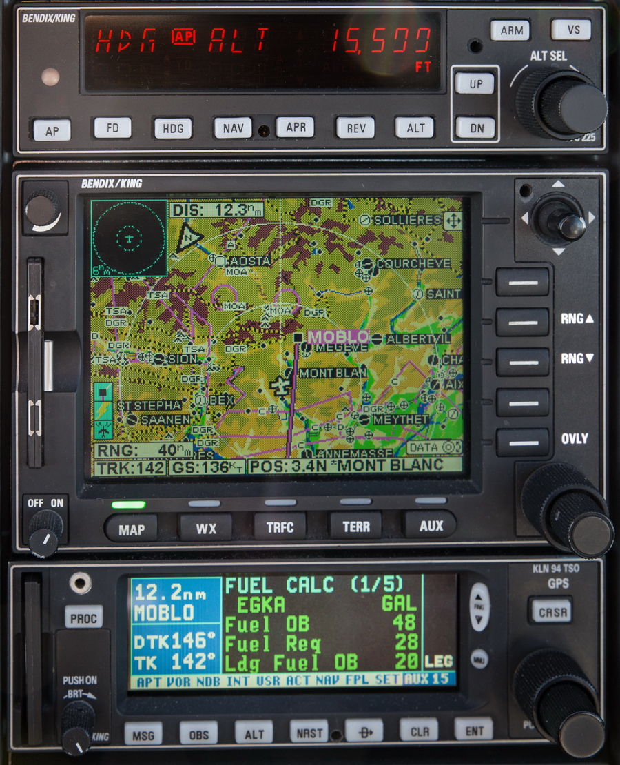
That is actually 16500ft; the display multiplexing is missing a segment, even though I normally use a 1/80 shutter speed. Maybe 1/60 will show everything. Actual altitude is 17200ft which is 1500ft above the summit
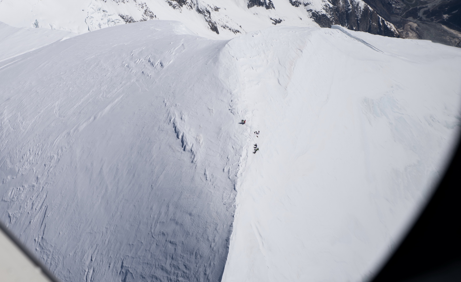
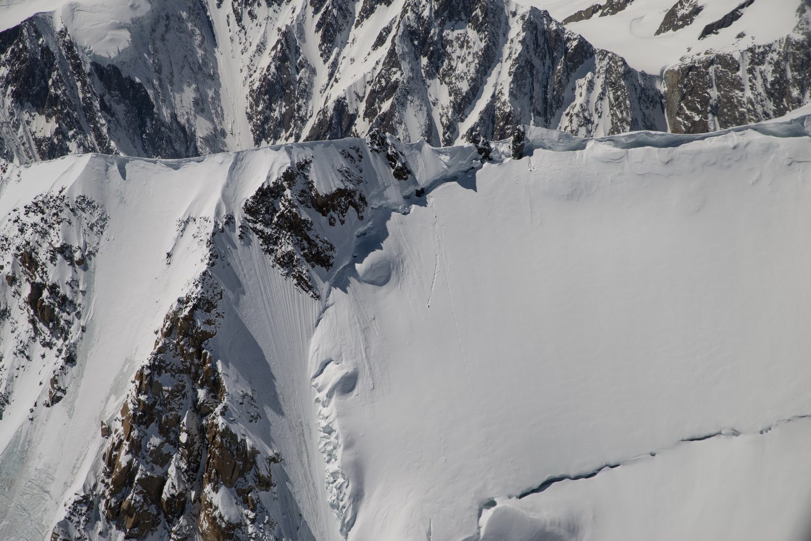
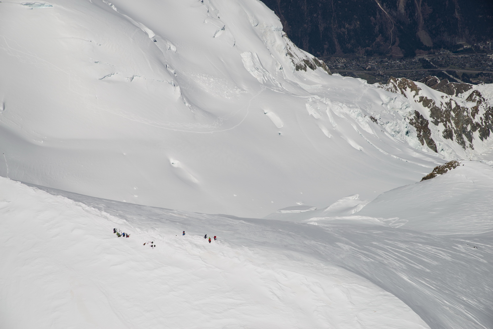
Finally - the summit of Mt Blanc! The video will deliver the best summit pics because I could not shoot straight down, but here is a series of pics. I crossed the summit twice and then flew around, taking care to be at least 500ft above the top for legal reasons (actual figure was 550ft). There were climbers on top:
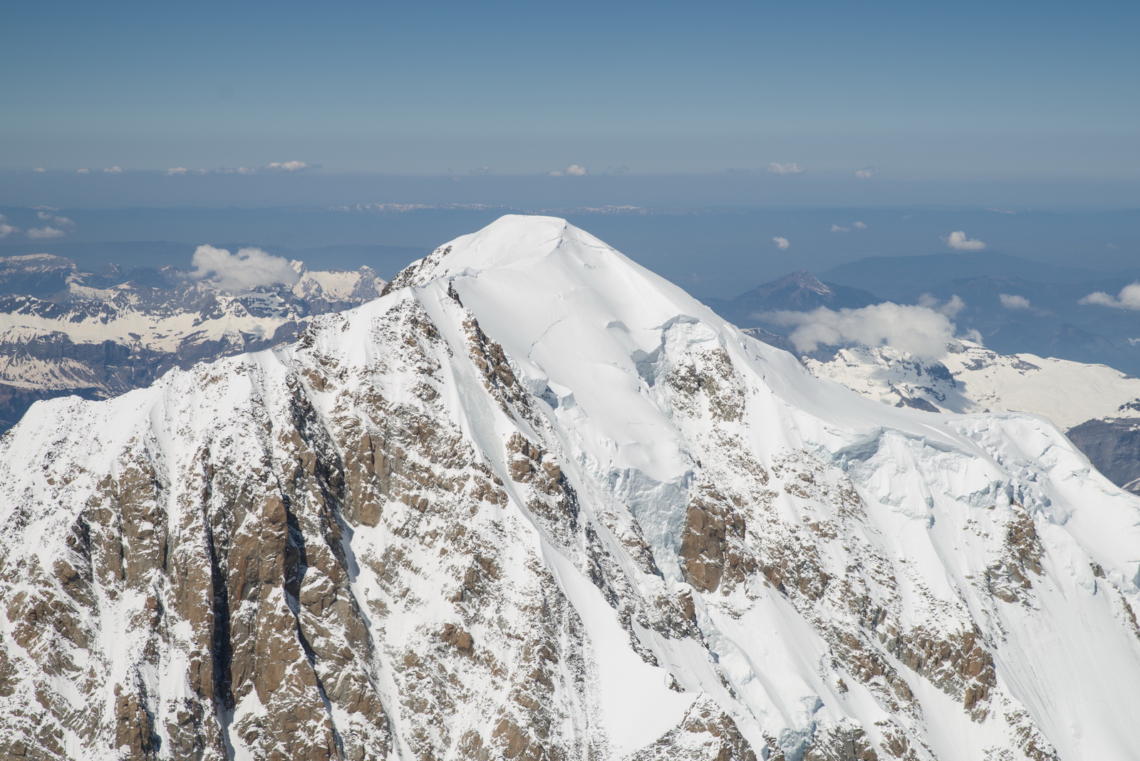

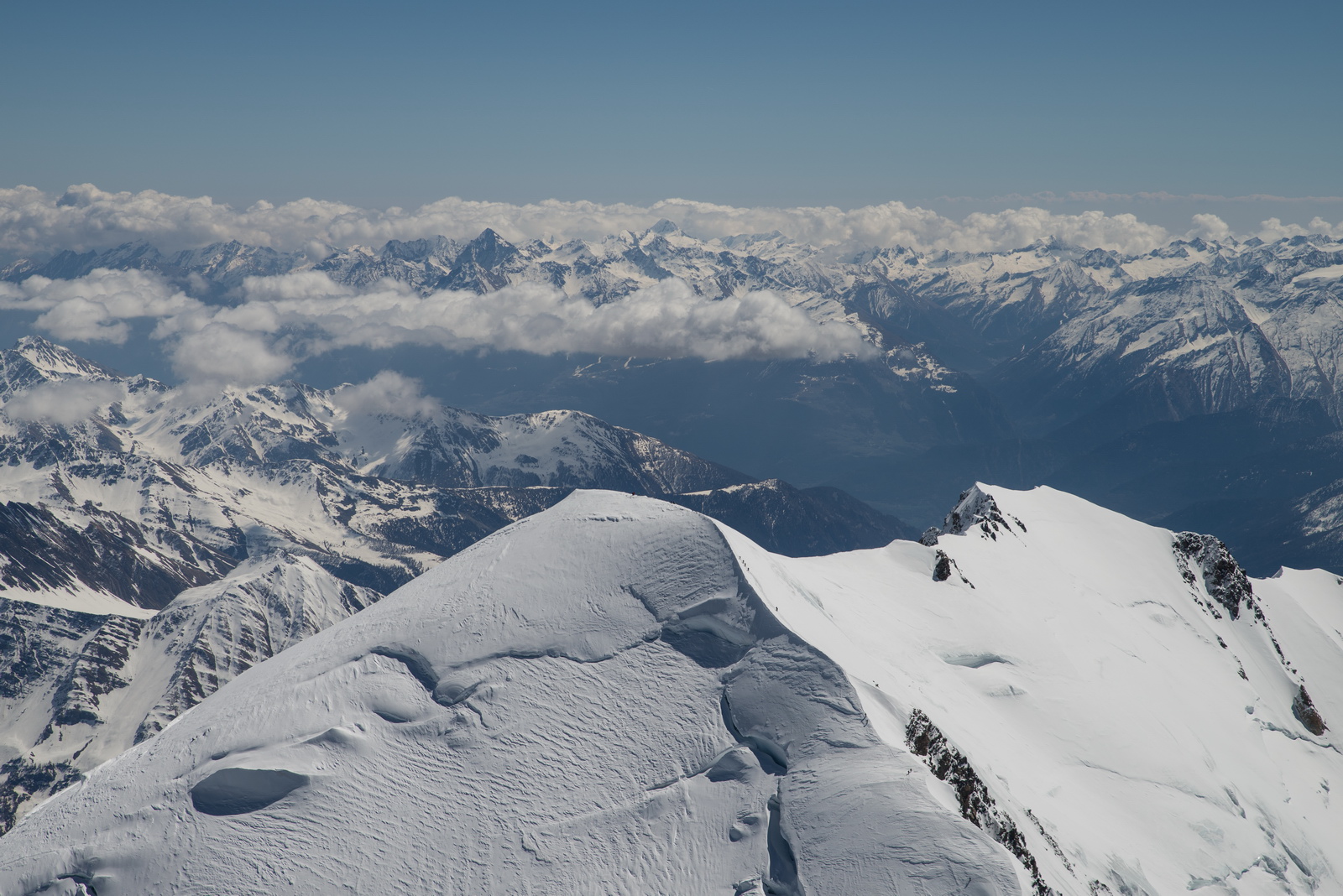
Mt Blanc mission completed - time to go straight back home


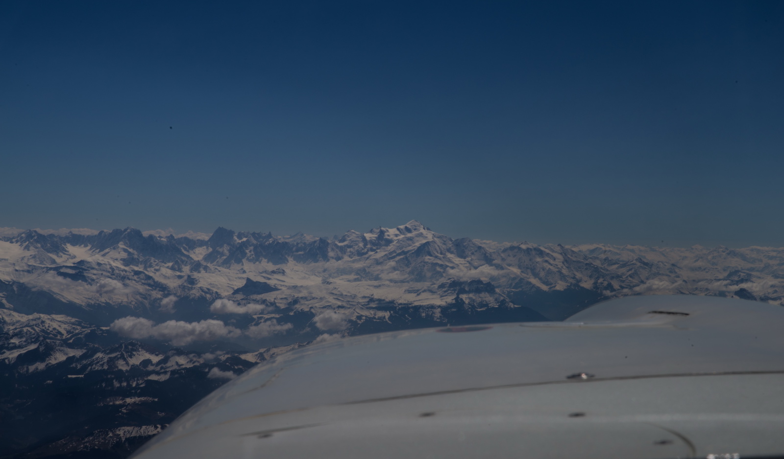
And goodbye Alps!
The winds didn't cancel out... the earlier headwind wind just dropped a bit and changed direction, so I got headwind on both routes. But only 5kt or less. It was forecast to turn into a tailwind later so I stayed at FL140 but it never happened, so eventually I started to descend
No shortcuts were allowed by French ATC. Paris TMA was totally no-go and all military airspace was totally active ![]() It is clear that they don't even bother to check nowadays; there seems to be a “non-relationship” between these units.
It is clear that they don't even bother to check nowadays; there seems to be a “non-relationship” between these units.
With 3G/4G connectivity sporadic at best, I used the excellent Golze ADL150 to get updates on the selection of UK airports. All were CAVOK. The ADL gets your GPS route via an RS232 connection and radiates all the stuff to the client device via WIFI. It is the best money you can spend on your aircraft
Nearly home. Zero wind here, and we are back to LFOB of 18USG.
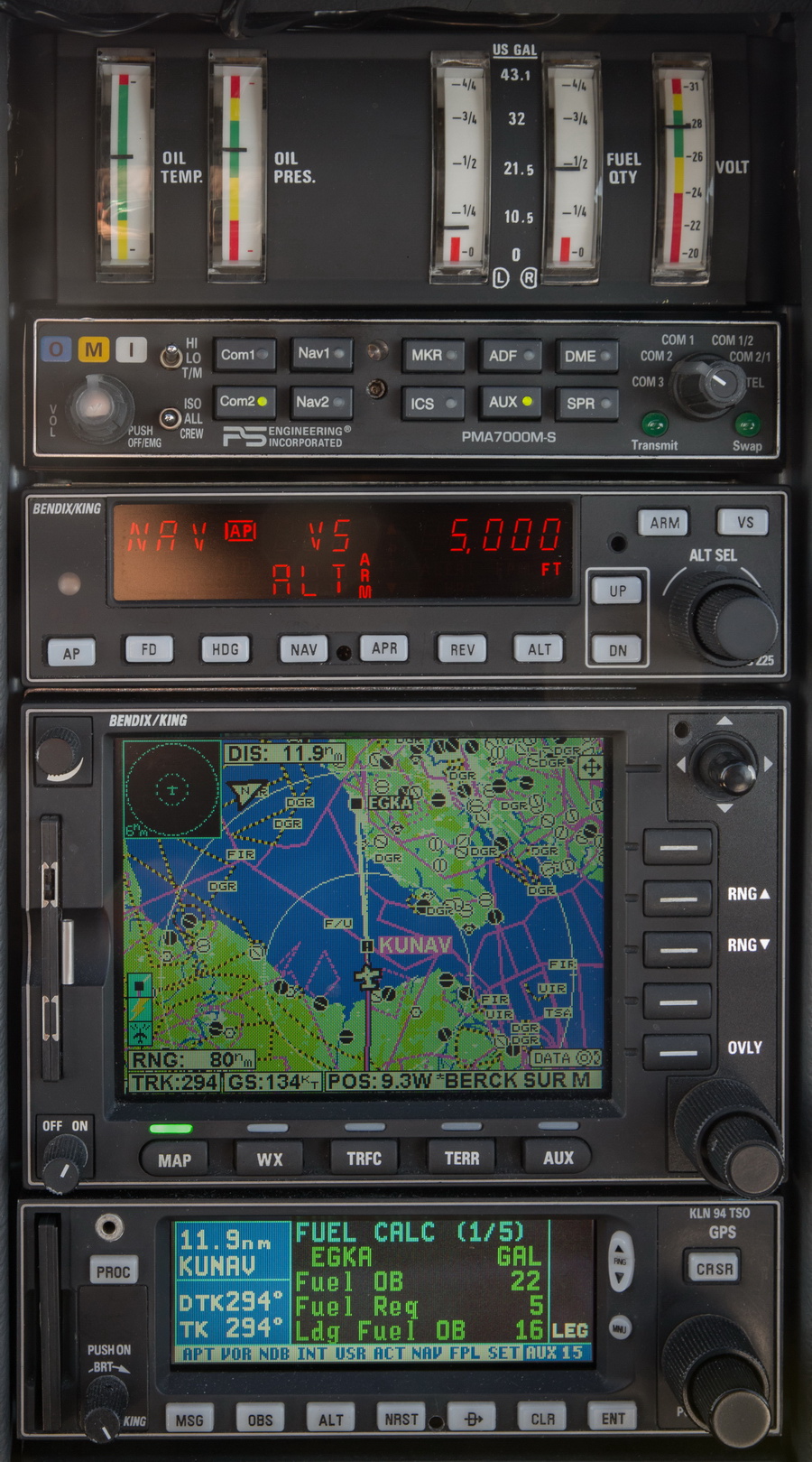
N French coast, looking back. Lille were quite proactive in telling me I have to descend below FL065 for the UK. The actual airspace base is FL075. I had a little conversation with them on the topics so well known on EuroGA i.e. a handover to London Control preserves your IFR clearance whereas a handover to London Information silently terminates it and you will get busted by the UK CAA if you continue thinking you still have the IFR clearance. It is an unbelievably dumb system which the UK runs to save ATC salaries. I think, after 10-20 years, this has finally sunk in in France and they understand this, but still today a foreign pilot, handed to “London 124.6” would bust the FL075 UK CAS at FL080+ so now, 2021, they are instructing a descent to FL065. I guess the CAA enforcer looks at whether the pilot is UK based and can thus be sent down to the Gasco "course", and foreigners are left alone. They must have got a lot of these busts…

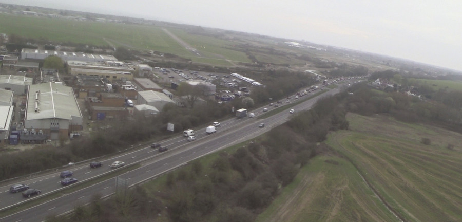
The UK coast at Beachy Head, Seaford, from around 4000ft

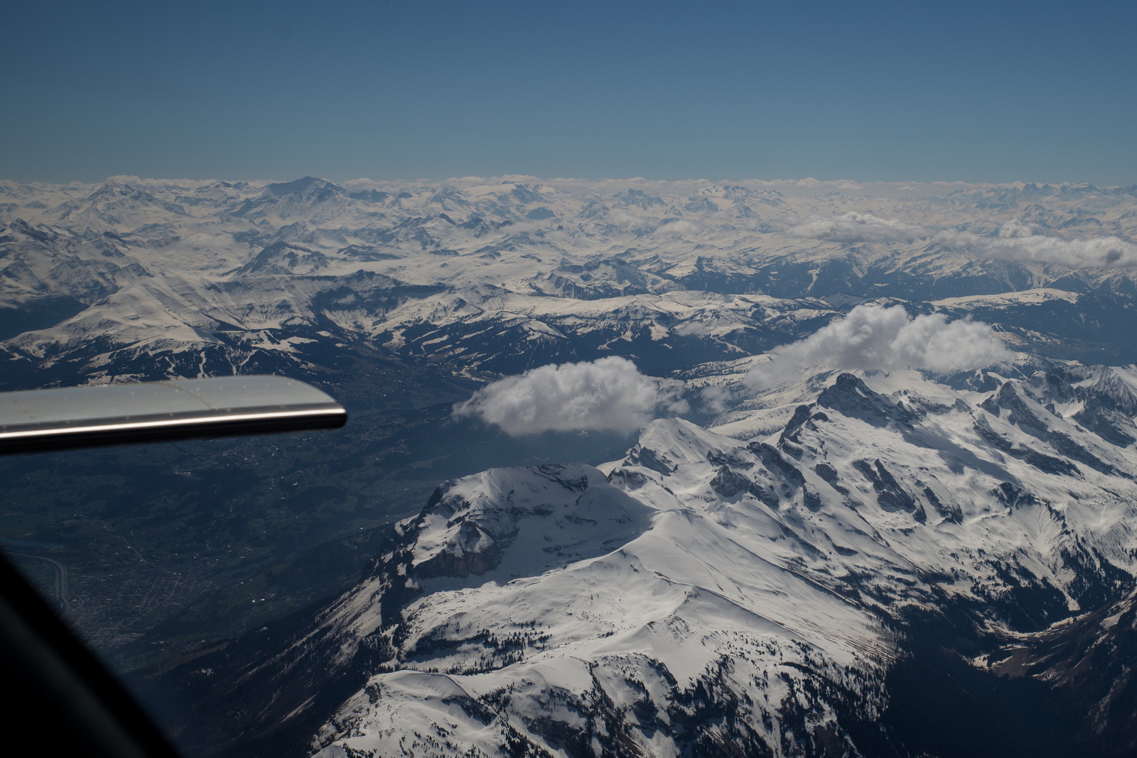
The wx on this trip was amazing. The pressure at Shoreham was very similar to the pressure around the Alps. It reminds me of the great summer of 2003 when I flew Shoreham to La Axarquia LEAX (near Malaga, Spain) and the pressure was 1013 all the way down. That was my first really long trip. All VFR (no IR then) and I had a big box of Jeppesen 1:500k paper charts and on a route like that I just worked through them one after the other...
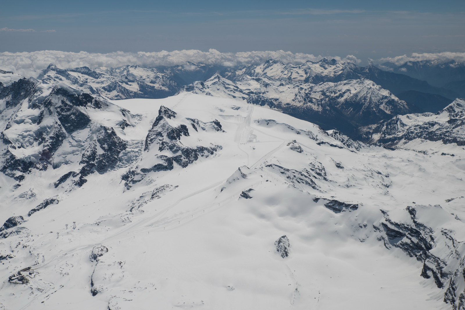
I wished I had bigger tanks. The Matterhorn summit could then have been done also. It was not safely doable on a EGKA-EGKA flight - the extra cost would have been around 8 USG. It was done on the next flight to Croatia, the very next month as Europe was slowly opening up after the worst part of the coronavirus crisis, and vaccination certificates were becoming available for travel.
This is the Flightaware route actually flown. There is no Eurocontrol tracking link because the flight could not be filed with the Autorouter. I got a EuroFPL tracking link instead but it expired by the time this was written
6:25 airborne time. LFOB 17.9 USG.
This is a video containing the entire flight and the ATC audio on the above flight. It was edited to be useful to pilots working towards the instrument rating:
As with the #1 trip there was no police "welcome team" which amazed me.
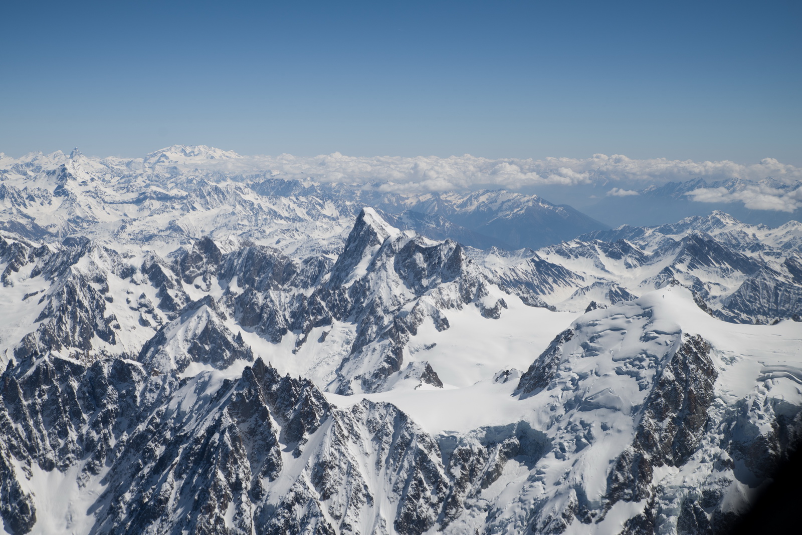
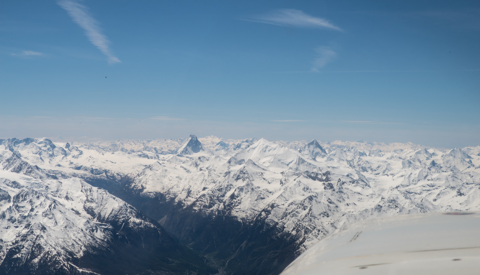
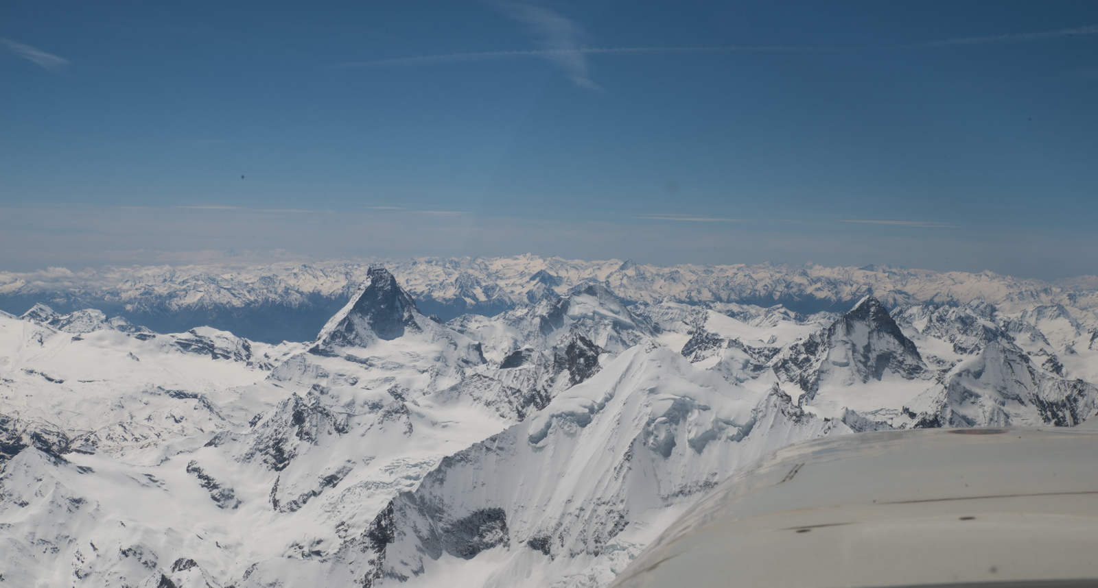
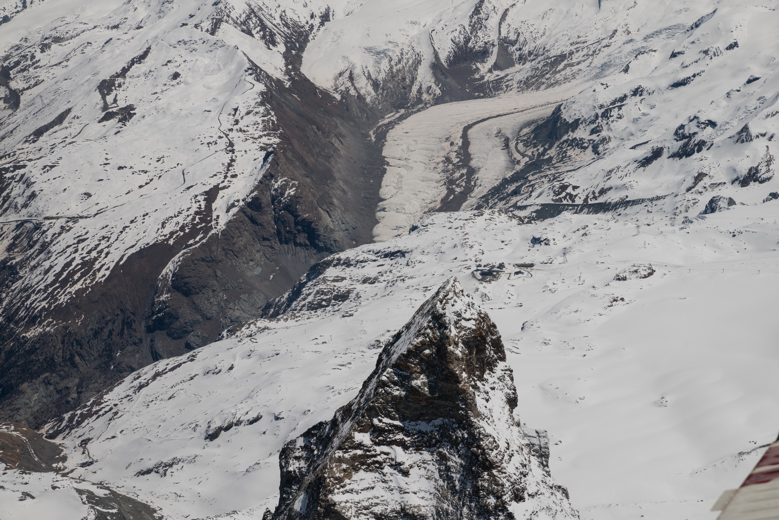
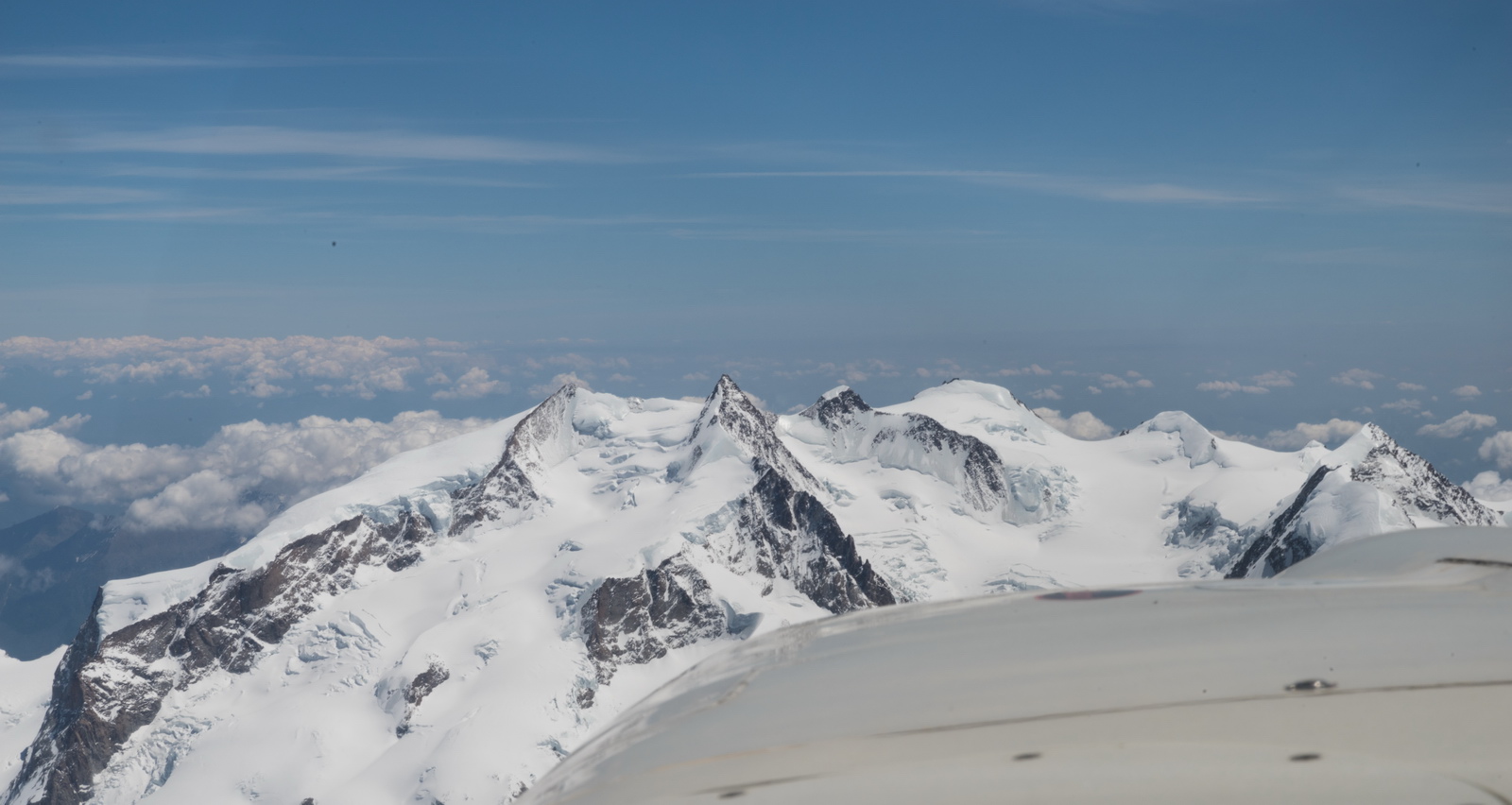
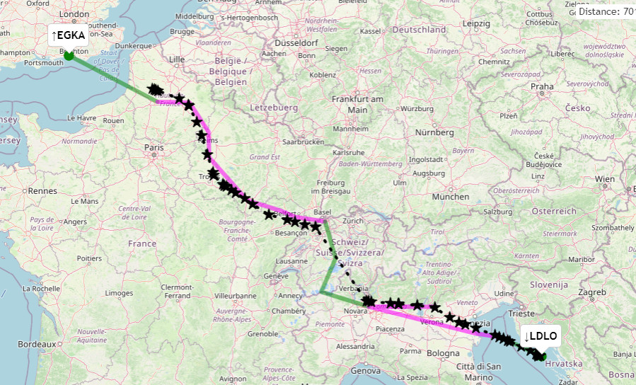
Trip #3 - Shoreham to Mali Losinj (Croatia) via Finsteraarhorn, Weisshorn, Matterhorn - May 2021
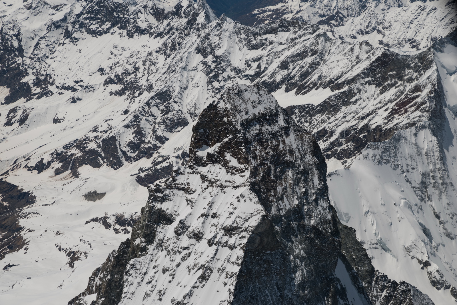
A further flight through the Alps, but not a UK-UK nonstop one anymore, was discussed here. This time there was no problem with the fuel, and due to the improving coronavirus situation there wasn't a problem landing to refuel if necessary. Croatia was accepting UK arrivals if vaccinated twice plus 2 weeks, and I had just met that requirement. Here we are presenting just the mountain pics, and a video which has an "interesting" sound track with some bizzare Swiss ATC stuff. I was not allowed to descend below FL160 so could not get very close. The details of this flight are here.
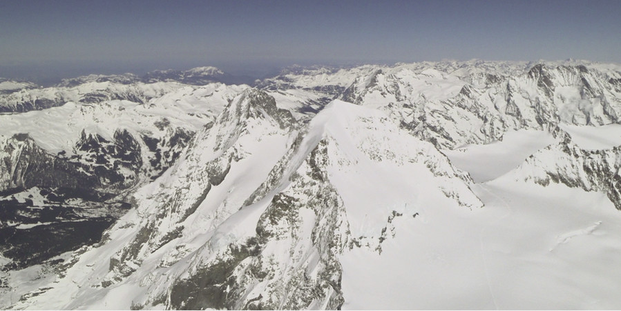
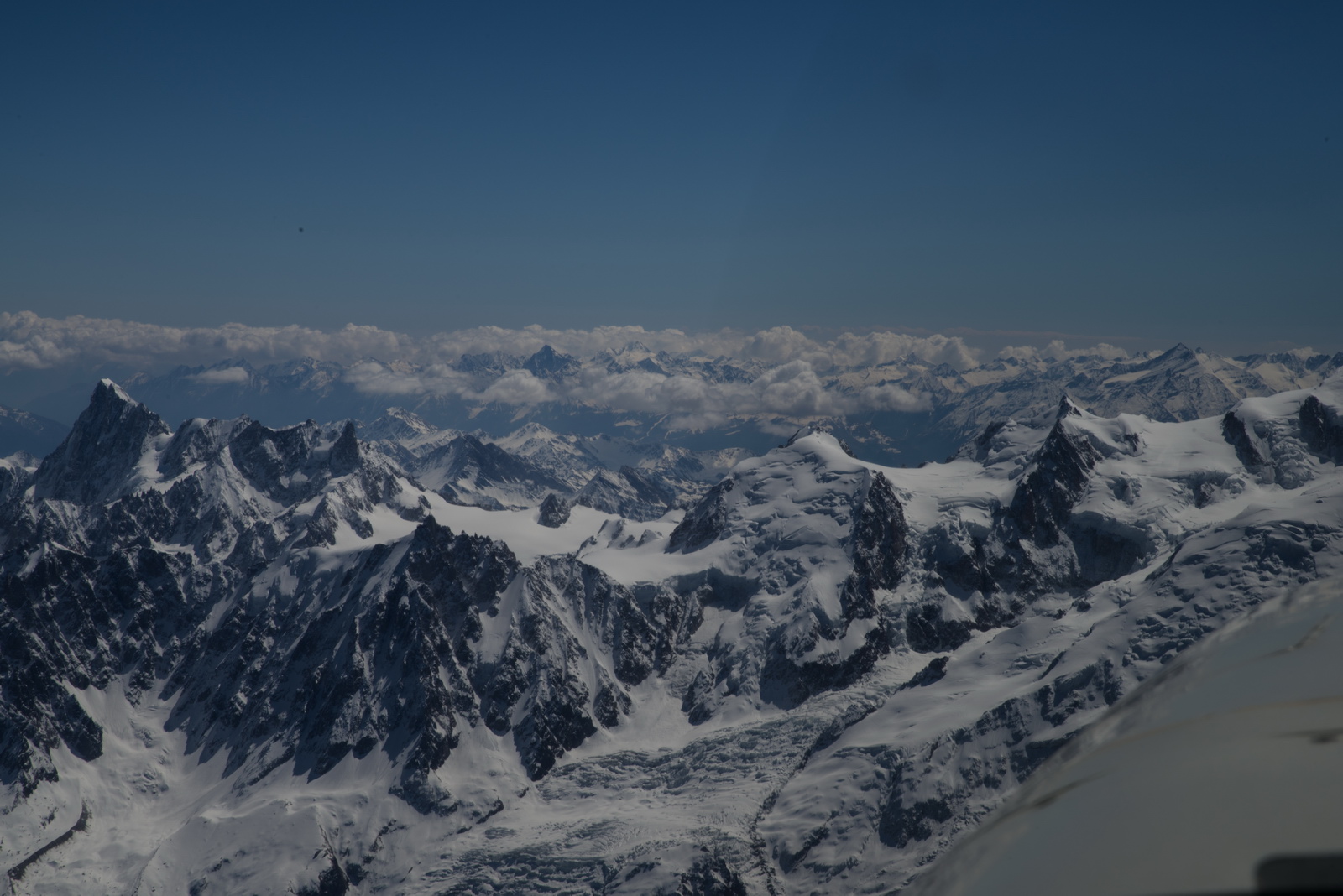
This is looking back onto Jungfrau, Mönch and Eiger; the subject of the #1 flight above. ATC limited the flight to not below FL160, so I could not get very close
Weisshorn is in the centre
Weisshorn and Matterhorn
Weisshorn immediately ahead
Glacier...

Matterhorn up close
That's probably Zermatt down in the valley
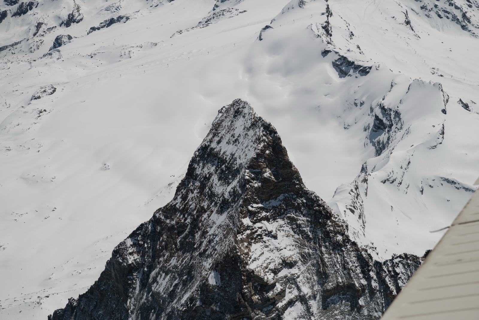
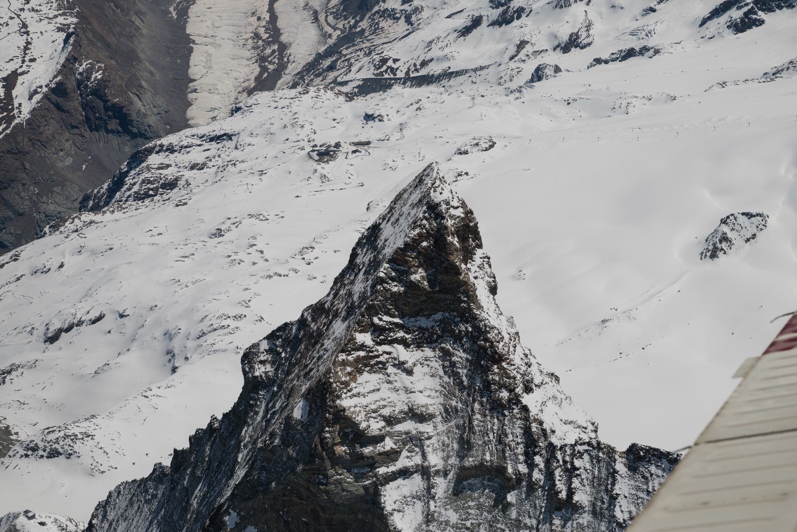
The Matterhorn looks very different depending on which side you are on. The classic picture is from Zermatt; from Cervinia it looks just like any other mountain.
Monte Rosa again - the 2nd highest mountain in the Alps
The video of the above trip is here, again with ATC dialogue. It has good views of the mountains, because the stills camera could never point straight down.
This shows the route actually flown, in black. It is partial only because Eurocontrol tracking is turned off on initial VFR sections, and got turned off when IFR was cancelled over the Alps
Oxygen
An oxygen system is practically necessary for IFR in the Eurocontrol system, for anything involving flight over the Alps (except, marginally, flying in the canyons, which I don't do). Occassionally, the weather is nice and one can fly at FL090 or so but most people would still get tired after several hours. Also many routings are not available below oxygen levels, due to controlled airspace structures, and in some cases terrain.
On this entire trip the usage was around 15% of the 48 cu. ft. cylinder, for 1 person. Without oxygen I would have not done the trip because one cuts off the top half of the aircraft operating ceiling (the Alps cannot be crossed, for example, unless you push your luck flying through the canyons, and one cannot climb above most cloud) and in the wrong conditions could spend most of the flight in icing conditions and turbulence.
The Value of an IR
The flights described could have been done under VFR, on similar routes, but probably with more "negotiation" enroute. And you would need to get enroute notams, very carefully, because ATC will not generally be looking after you. The real value of an IR is not to fly in IMC; it is the fact that ATC works with you rather than (as so often) against you, so you get access to airspace and altitudes where you can fly in sunshine.
This page last edited 5th November 2021