
Trip to Zurich - April 2009
Objective
This article describes a very straightforward IFR (airways) trip from Shoreham (EGKA) in the UK to Zurich (LSZH) in Switzerland, and back the following day.
Procedurally, the flight was very similar to other airways flights I have done. Other VFR and IFR trip reports can be found here. With the exception of weather strategies, IFR (airways) flying follows a standard pattern.
I have written up this trip because it makes a good example of a quick and easy IFR trip in Europe - around 3 hours each way - which is ideal for the capabilities of this aircraft.
Here is a glossary for non-aviation readers.
Aircraft
The aircraft is a 2002 Socata TB20GT which has a zero-fuel "book" range of approximately 1100nm and an economical cruise speed of 155kt TAS at 10,000ft. Extra economical cruise power settings can extend the zero-fuel range to 1300nm. It has a ceiling of about 20,000ft and is equipped with oxygen. It is not certified for flight into icing conditions but has a TKS de-iced propeller.
Navigation equipment includes a KLN94 IFR/BRNAV GPS and a KMD550 MFD and these are used for primary navigation. The aircraft has a KFC225 autopilot which can track VOR/GPS/LOC/ILS and fly a preset altitude or a preset VS. There is an additional battery powered Garmin 496 GPS which also provides an audio terrain warning (TAWS) function with a European terrain and obstacle database. A WX500 stormscope is also installed.

Flight Planning Equipment
The preflight planning for the first leg of a multi-leg trip is done while still comfortably at home, but one needs to do it all when away, too. On any significant trip I carry a laptop (Thinkpad X60s 1704) and sometimes the Canon IP90 lightweight portable printer. However, on this short trip I took a new device: the ASUS 901 "EEE" laptop

This very compact laptop (8" screen) cost a mere £220 (3/2009) and has just 8GB of flash "hard drive" storage, but it is sufficient for everything that a travelling pilot may need for flight related operations: flight planning software (Navbox for VFR and Jeppesen Flitestar for IFR/airways), approach plates and enroute charts in electronic format (Jeppview), various mapping programs (Memory Map and Oziexplorer), and all the usual internet facilities (www, email etc). Internet access is via WIFI, GPRS and 3G, with the latter two being over a bluetooth link to a GPRS/3G mobile phone. This enables one to get weather, notams, file flight plans, send faxes to airports (using an email2fax service), and it enables routings to be re-worked anytime on the ground. It can even connect via bluetooth to a Thuraya satellite phone for internet and fax functions anywhere. Any flight related software which can use a GPS input (Memory Map, Oziexplorer, even the rather buggy Jeppesen FliteDeck) can deliver a moving map via a bluetooth connected GPS. It always takes a good day or more to configure any new PC with the obligatory Micro$oft patches/updates, and a pile of one's own software, but setting up the internet access using a mobile phone (in this case, a Nokia E51 as shown) took just minutes. Battery life is around 5 hours. Some notes on mobile connectivity are here.
This capability achieves independence from airport weather briefing and flight plan filing services which at best are an unpredictable waste of time and may be missing altogether.
Preflight Procedures
Flight plan filing was done electronically, using AFPEx for the outbound flight and Homebriefing for the return one. The decision to use the two different services was entirely random; Homebriefing charges around Euro 4 per flight plan so there is an incentive to use AFPEx whenever possible (even though it requires a high speed cheap/free internet connection) but Homebriefing does not charge for flight plans terminating in Switzerland or Austria, and offers SMS/email notification of slots, etc. More notes on electronic flight plan filing options are here.
IFR route design: The Eurocontrol IFR routing was generated and validated online in just minutes using the AutoPlan route generator - example. Another program with a similar capability is FlightPlanPro. The development of these routing tools has revolutionalised European IFR flight planning, by eliminating the need to procure the SRDs (standard route documents) for various countries.
The originally generated outbound route was
FL100
EGKA DCT MAY R8 DVR L10 RINTI B3 RLP G4 LUL G42 ARPUS/N0148F120 G42 BLM LSZH
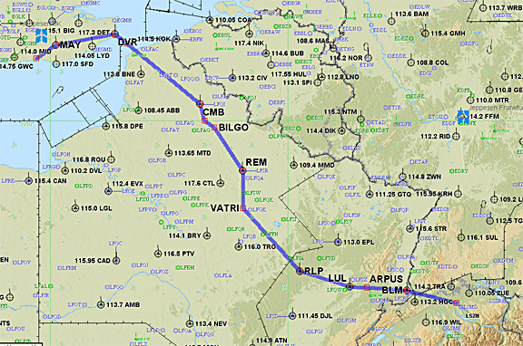
Partly due to the "diversion" near the start, this had a 15% overhead, and tinkering with the first portion by inserting a couple of DCTs produced a very slight improvement
FL100
EGKA DCT LYD DCT TRACA B3 RINTI B3 RLP G4 LUL G42 ARPUS/N0148F120 G42 BLM LSZH
Distance: 401nm (GC); 451nm (airways)
Alternate: Friedrichshafen EDNY
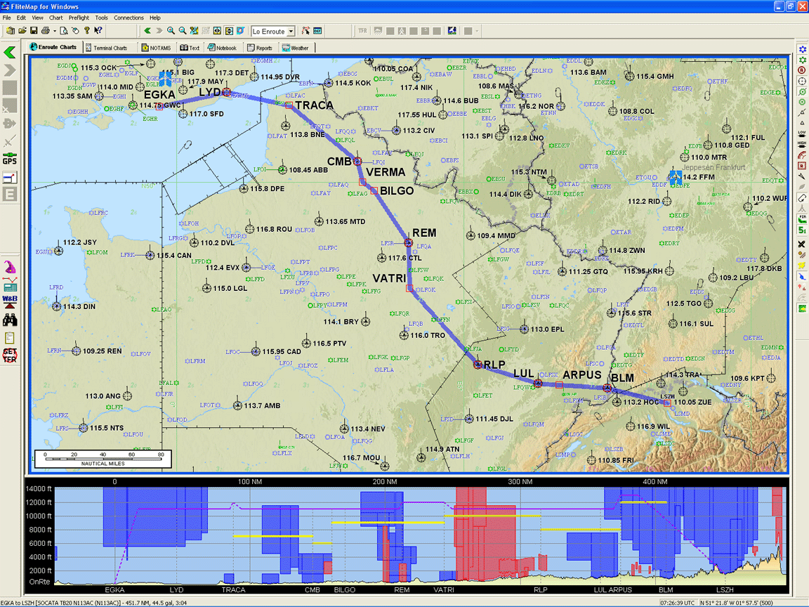
which validated OK at an initial level of FL100.
The AFPEx ACK message arrived within a few seconds, as always with AFPEx which is a direct AFTN interface.
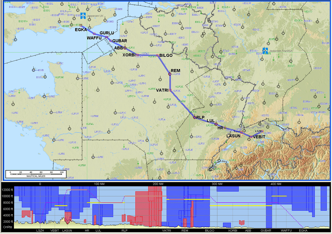
The return route was also preplanned at the same time:
FL100
LSZH VEBIT T51 LASUN/N0148F120 T51 HR/N0155F100 G4 RLP B3 BILGO H20 XORBI H40
ABB T27 GURLU Y8 WAFFU DCT EGKA
Distance: 401nm (GC); 446nm (airways)
Alternate: Bournemouth EGHH
However, there was a catch. When the Homebriefing acceptance arrived, after a delay of 15 minutes, the flight plan was found to have been amended with the FL090 at the beginning
F090
LSZH VEBIT T51 LASUN/N0148F120 T51 HR/N0155F100 G4 RLP B3 BILGO H20 XORBI H40
ABB T27 GURLU Y8 WAFFU DCT EGKA
Their only change was from FL100 to FL090. This was curious as I did not specify the "reroute accepted" option. The explanatory message which came back from Homebriefing was
GOOD EVENING
YOU HAVE PLANNED FLIGHT LEVELS MORE THAN FL090, SO YOUR ACFT HAS TO
BE RNAV EQUIPPED. PLEASE AMEND YOUR FPL ITEM 10 WITH THE LETTER R IF
YOUR ACFT IS RNAV EQUIPPED OR PLAN A ROUTE BELOW FL100.
I had never seen this before... BRNAV is mandatory in Europe above FL095 but Eurocontrol does not validate an RNAV equipment declaration against the filed level. As the outbound filing was accepted without a complaint, this looks like an in-house Homebriefing policy rather than a change at Eurocontrol. In any case, the outbound route was also filed without an RNAV equipment declaration and was accepted OK. Normally I file with equipment specification of S/S and in this case I changed it to SGR/S and refiled for FL120.
Note: the Eurocontrol routings given here and elsewhere will most likely not work by the time you might try them because the precise form needed to get the route into the Eurocontrol (IFPS) computer in Brussels changes from one week to the next, and there are frequent differences between weekdays and weekends which are largely due to a lack of military activity on weekends.
Beware: the terrain profile shown in the route illustrations (e.g. the one above) is not accurate. The Jeppesen Flitestar software contains large elevation errors. Also, the flight level shown in the profile diagram does not relate to the flight; filed or actual.
Notams were obtained using the traditional UK NATS website. I use the Narrow Route Briefing only and one simply pastes the airways route in there. With IFR flights, enroute situations (e.g. restricted areas due to airshows) are not normally an issue because Eurocontrol and ATC will make sure no airways traffic is routed where it should not go, but notams remain vital for airport information such as out of service instrument approaches and PPR requirements. They are also vital for start and end portions of an IFR flight where one transits uncontrolled airspace, where no meaningful (i.e. radar) ATC service is usually available and where some restricted area could be infringed.
PPR (prior permission required) is a disease which is spreading through airports in Europe and elsewhere. The usual pretence is that the airport needs to "regulate apron capacity" - even if it is big enough to park the whole of its air force plus the air forces of its enemies. It is highly desirable to obtain a positive confirmation from the destination, and if one cannot establish contact with a phone call, it is best done by faxing (repeatedly as required) a form along the lines of this one. In this case, with an airport where one can expect people to speak English pretty widely, it was simpler; I called the main GA handling agent MFGZ on +41 76 568 2483; Zurich has "mandatory handling". They took my details and that took care of everything. The one advantage of using a handling agent is that they will deal with any gotchas like PPR or arrival slots, parking restrictions, etc, and if the airport is refusing a landing permission due to PPR etc, you just tell them that it was cleared with XYZ Handling...
Weather
My usual sources for weather for IFR/airways trips are the MSLP charts in the first instance which are available up to 5 days ahead and show obvious features, the SigWx form which shows weather above FL100 (available about 18 hours ahead) and TAFs/METARs for departure, destination, alternate, and perhaps some airports along the route. For more short-term detail, this data is supplemented with weather radar, sferics and satellite images.
Airways flight in Europe has to be done at certain minimum altitudes (the airway MEAs) and if there is any cloud these altitudes would normally place the aircraft into cloud. Therefore, given a non-deiced aircraft without radar, my conservative strategy for IFR flight is to climb until VMC on top is reached and stay there in the sunshine for the entire enroute segment. Anything else can result in an unpleasant and potentially turbulent flight with - especially over hours - a high chance of icing. Another risk in entering IMC when enroute is that one obviously cannot see ahead and a serious deterioation in the conditions cannot be detected until it gets bad enough to show up on a stormscope or on radar. Therefore, I supplement the above weather sources with more modern sources such as Meteoblue and NOAA which offer data on vertical cloud profiles, as well as offering longer range forecasts, with a view to cancelling the flight if cloud tops are firmly forecast enroute above the aircraft operatin ceiling. However, the quality of cloud tops forecasting remains poor and one is doing well if the forecast is within a few thousand feet of reality! Some notes on cloud top data are here and a more general tutorial for IFR weather planning is here.
For this trip, for the day of departure (planned for 0715Z) the 0600 1200 MSLP charts showed a lack of fronts along the proposed route, which is always a good start. UKMO Winds aloft data suggested a general tailwind, confirmed by GFS. As for SigWx, the 0600 1200 1800 showed nothing significant, with the 1800 one suggesting a worsening later in the day but I would have landed long before then. Curiously the 1200 one is blank!
I am not very fond of the SigWx form because it depicts only "hazardous weather", above FL100 only. It does not show cloud tops! You could have a clean SigWx form and could spend the whole flight in IMC and probably icing, and that assumes the forecast is correct. I use the SigWx as a no-go indicator; if, together with some other data, it shows bad weather to a high altitude then I scrap the flight. The SigWx is probably OK for seriously de-iced aircraft with radar.
The 0000Z weather baloon ascents for the departure, mid-route and destination areas showed no significant cloud. The value of ascents which are a number of hours old is limited but it gives an idea of the kind of airmass which is lingering around a high pressure area. If the 0000Z ascent shows IMC to FL160, with the upper 10,000ft of that below 0C, then one needs to ask serious questions about where this stuff has gone by the time of departure of say 0700Z - if indeed it has moved at all... If the said weather is clearly associated with a front passing through, that is fine, but if it is found in the middle of a non-frontal airmass then it could be anywhere, hours later.
For good measure, the weather radar and sferics data showed nothing.
Finally, on the morning of the flight I got the TAFs and METARs which showed nothing significant.
The return flight weather was examined on the MSLP 0000 1200 charts and looked OK. I do cancel quite a lot of trips due to return weather issues because the instrument approaches at Shoreham have a high MDH (in prevailing winds, 800ft) and thus poor utility for getting back home.
Some of the above weather data is from Avbrief (which I like to use because it has most things in one place) but all the weather data above can be found on the internet for free!
Fuel Planning
The flight to Zurich was done against a tight time schedule for a meeting and the short distance, under 500nm, meant that fuel was not an issue. A well managed TB20 could just about fly to Zurich and back without refuelling.
The Flight
The Shoreham (Class G) departure clearance was: "remain outside controlled airspace, on track SFD, squawk 0573, contact London Control on 133.175".
The base of controlled airspace is FL055 so one sets FL054 as the target level on the autopilot...
On first contact, London Control asked for the customary squawk ident and then issued a clearance to enter controlled airspace, on track SFD, climb FL080. This was later increased to the filed FL100.
There was some cloud in the distance with tops around FL100 so I asked for a climb to FL120. London Control reported that the French will not allow anything above FL110 so I settled for that.
Soon after, when I was asked to contact Lille instead of the usual Paris Control, it became apparent that the modification I did to the original route came at a price: there was some military activity in the area (through which I filed the DCTs) at FL120+. It was just as well that the cloud tops were not any higher... had they been higher I would have probably had to revert to the original route to get the climb options. This was a lesson re-learnt: verify and file the flight plan for a higher level e.g. FL150.
Due to the non-critical fuel situation and the time constraints, I used the best-power engine setting of max RPM (2575) and 100F ROP (rich of peak). At FL110, this produced a very respectable 165 kt TAS at 13.4 GPH (OAT -5C, MP 19.5").
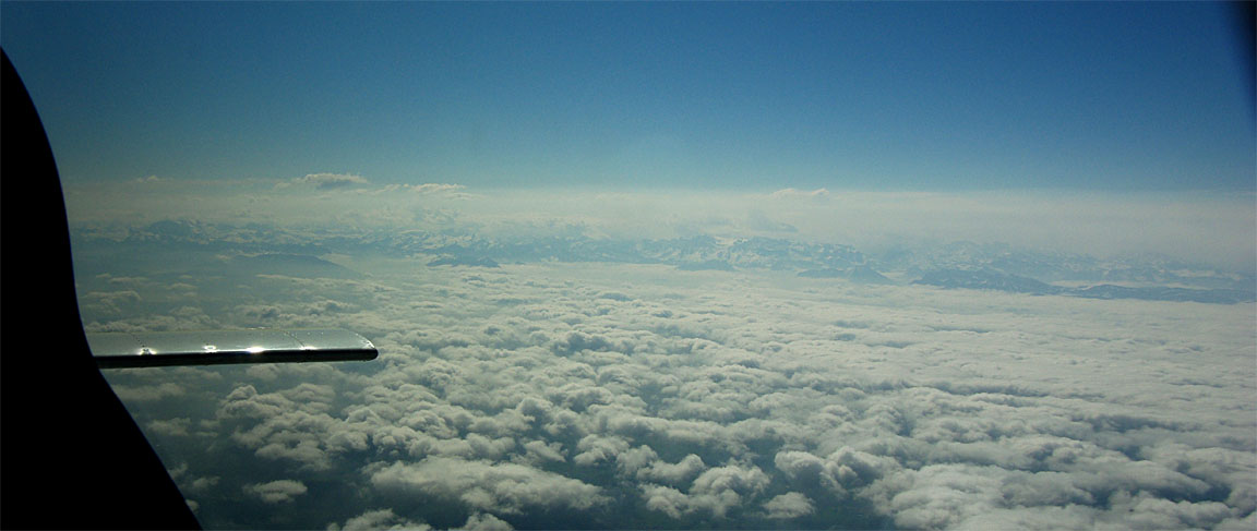
The weather conditions were pretty good, with a lot of haze going up to about 8,000ft over the UK towards Dover
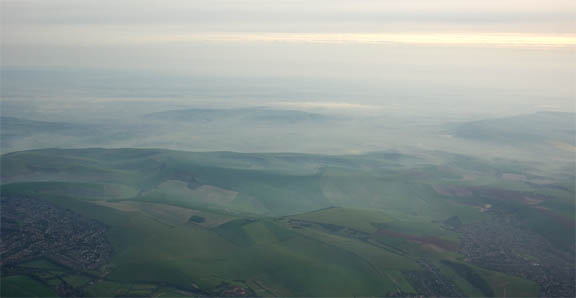
The initial part of the flight was above the haze but below another thin layer
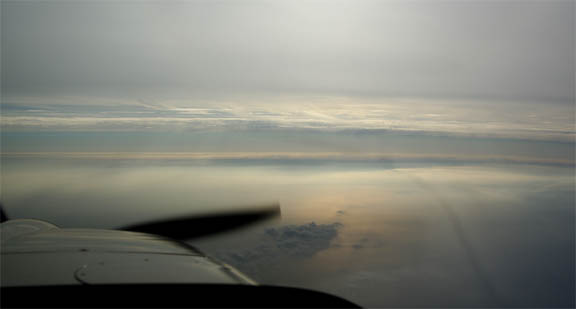
and the flight continued over France and into Switzerland above some scattered cloud
The rest of the flight was uneventful, with transfers to Paris Control, West Control (France), and finally Basle and Zurich.
I normally try to find out early (from ATC; 50-100nm before arrival) what runway is active so I can get the approach plates sorted into probable order, read the immediate ones in detail and set up the avionics in plenty of time. Normally, back home, I scan all plates (departures, arrivals, inctrument approaches) for any suprises but like most big airports Zurich delivers far too much bedtime reading material: ninety pages of which the great majority will always be irrelevant, so one needs to narrow it down as much as possible to minimise the cockpit workload later on.
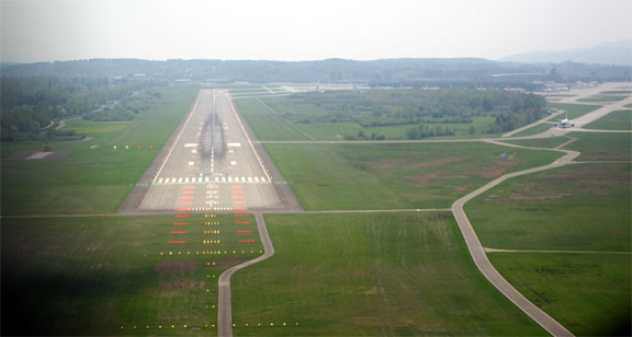
The STAR (standard arrival route) is supposed to match the terminating point of the filed route (BLM in this case) and you have to be ready to fly it, but actually flying it is not likely in the European radar control environment where radar equipped approach controllers use radar almost exclusively for tactical traffic management. SIDs (standard departures), on the other hand, are nearly always assigned and flown as published - even if generally not all the way to their terminating waypoint. A pure "radar departure" is rare. Some 50nm before the destination I found out that the runway was 14 and there would be a radar vectored ILS; no STAR was given so this was going to be the simplest approach possible.
Prior to reaching BLM, Zurich sent me to HOC instead and about 30nm before Zurich I got a little suprise in the form of a hold at GIPOL, at FL110. This hold is well before the instrument approach and thus appears on the STAR diagram. Being a published enroute hold, it is a right-hand one and in this case it is most conveniently entered directly on the route from HOC. I could swear the 737 which was 1000ft above me in the hold was going around it in the opposite direction but he was probably just flying a parallel hold entry. I checked with Zurich just in case, to make sure it was a RH hold. Zurich advised that I should expect to go around the hold twice. Of many IFR flights around Europe, this was the first instance of an ATC requested hold. GA flights rarely get holds, probably because the lower speed causes ATC to separate them vertically from the jets, as well as giving ATC more time to work out what to do with one, using extended vectoring etc. Flying a hold with modern avionics is a piece of cake.
On the 2nd or 3rd time round, Zurich gave a vector of 050 straight out of the hold, and issued descent instructions to FL100, FL070, 6000ft (with a QNH), 4000ft and a clearance for the ILS14. I was descending at -800fpm but still managed to end up marginally above the instrument approach platform altitude (and thus marginally above the glideslope) at the localiser intercept; this just about prevented the KFC225 autopilot from intercepting the GS. Increasing the autopilot descent rate to -1000fpm resulted in a glideslope intercept. Being vectored above the glideslope is quite common and one needs to descend pretty fast; -1000fpm or more if possible.
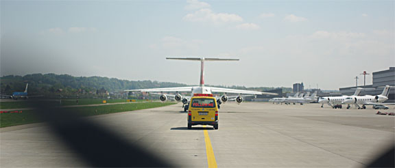
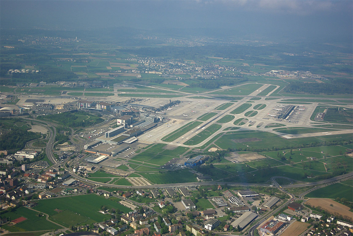
Zurich is a big airport and it is a long taxi, behind a FOLLOW ME vehicle preceeded by several of what looked like 146s
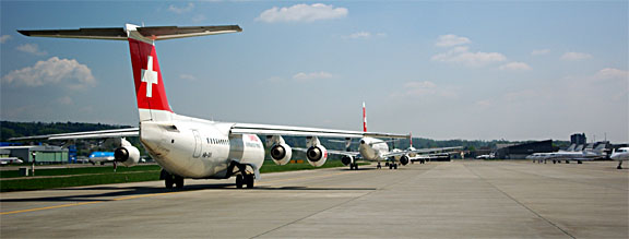
Zurich has a lot of classy private customers
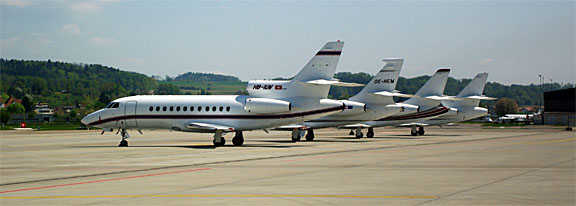
Eventually, one of the several GA parking areas is reached
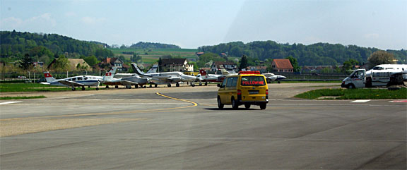
Despite its size, Zurich caters very smoothly for GA at every level, from approach control to parking, and has extensive GA facilities where everything just works and nothing is a big deal. There is a lesson here for the bigger UK airports, which have dealt with GA by simply pushing it out by means of silly landing+handling fees (around £500 at Gatwick) but their inflexible management is hardly going to be interested...
Avgas turned up within a few minutes. Landing fuel on board, from the fuel totaliser, was 45.0 USG which is just over 50% of the tank capacity of 86.2 USG. Using a more economical power setting, Zurich and back without a refuel is thus completely possible, if rather pointless. The bowser delivery (156 litres) was within 0.2% of the fuel totaliser computed value (86.2 USG full, 45.0 USG landing FOB); this is the most accurate result I have ever had with a bowser but in Switzerland one should expect nothing less than perfection!! I have found some bowsers to be up to 7% out of calibration; invariably in a direction that favours the airport. The TB20 is a great load carrier, with its efficiency hardly affected by fuel weight, so I always fill right up and this renders any bowser error immaterial except to the cost of the refill. I try to use the AIR BP fuel card on every possible occassion - it avoids fuel pricing scams that can run at certain more "southern European" airports.
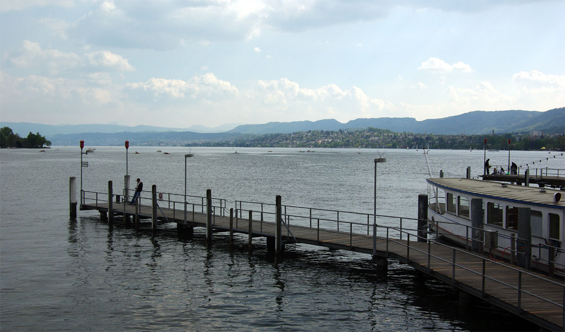
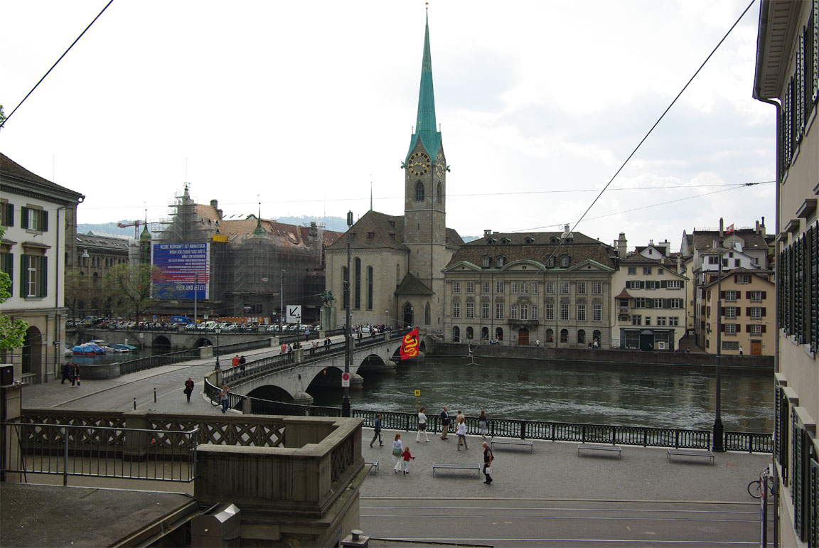
Zurich
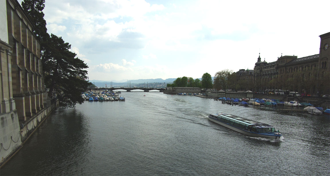
Following my meeting, I had just one afternoon in the city which was enough for a survey of the lakeside, and buying a load of chocolates...
One could not miss the hordes of immaculately looking (occasionally immaculately preserved) high-maintenance women carrying bags of designer clothes but I did not get any pictures of them :)
To get back to the airport, one has a choice of a taxi (approx Euro 70 - very expensive but this is Switzerland) or the #10 tram (with "Flughafen" on the front) from the city centre for about £3.50. I took the tram which takes about 30 minutes. The tram terminates at the airport anyway but there are two stops named Flughafen; the first is the main airport entrance and the second is near the GA terminal. Predictably I took the main airport stop and was relieved of a bundle by a taxi to take me the extra few miles...
Return Flight
The 1200 MSLP and the 0600 and 1200 SigWx showed nothing of significance. The TAFs and METARs were fine also, with some low cloud around Zurich.
On the way out, everything is x-rayed etc. There is mandatory handling but the handling agent MFGZ was very efficient and the total bill (1400kg landing and 1 night's parking) was SFR 107 (approx £64) which is reasonable for such a large airport.
I had too much spare time but had to be back home for another meeting, so I got the handling agent to bring back the departure time by a few hours. This instantly produced the expected SMS message from Homebriefing that the old flight plan had been cancelled, but the new flight plan was never thus notified. I now know why this is: Homebriefing can see only flight plans filed via its own web interface and held in its own private database, but the modified one was injected into the AFTN via Zurich's tower terminal. These little quirks are explained at the end of this writeup.
As with most large airports, one collects the departure clearance from the Delivery frequency. The initial waypoint of the filed return route was VEBIT and for the active departure runway 10 this suggested the VEBIT 2E SID (standard instrument departure). Like all Zurich SIDs departing in the relevant direction, this is an RNAV SID. There are a few old-style SIDs which are traditionally flown using VORs etc or with an IFR GPS. There are also some PRNAV SIDs which can be easily flown with an IFR GPS but are legal only with PRNAV certified aircraft - almost unheard of in GA. Due to a dumb policy of Honeywell, my IFR GPS (KLN94) database does not contain most RNAV SIDs/STARs so I advised Tower that I am unable to fly VEBIT 2E; their relaxed response was "fly the overlay" which is readily apparent as being based on some VOR radials, and in any case all the RNAV SID waypoints BREGO, ZH554, ZH558 and of course VEBIT are in the database, so doing this departure for real was trivial. Tower re-checked with me that VEBIT 2E was OK.
The departure clearance was simply Runway 10, VEBIT 2E departure, squawk 3012.
The taxi back out does not get a FOLLOW ME vehicle - you have to work it out yourself on the airport map! One must always ask for taxi instructions if in any way uncertain - getting lost at big airports is quite normal even for passenger jets - and the tower controller was most helpful. This picture was taken at the departure holding point, where there was a 10-15 minute total wait due to wake turbulence spacing
Immediately after departure, I got a climb FL080 DCT LASUN, followed by climb to FL110 and FL120 and then DCT LUL. All very straightforward
The Alps immediately appeared to the south, with quite a lot of haze around


but were soon left behind in the distance
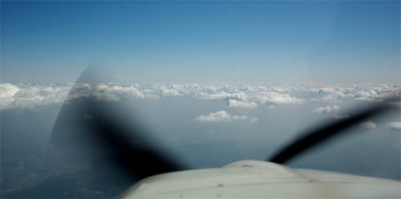
The weather was perfect, with just a lot of haze below the operating level.
For test purposes I climbed to FL200 which was readily approved by French ATC
This is the certified operating ceiling of the aircraft which performed perfectly, climbing the last 2,000ft at around +150fpm using the KFC225 autopilot pitch-hold (PIT) mode, used in conjunction with the CWS function to manually adjust the pitch attitude. The selectable-VS (VS hold) mode of the autopilot cannot be used at these altitudes because the autopilot has a software defect which modifies the pilot-selected VS figure by 100fpm either way (usually downwards) so if you actually select +100fpm you might get it, or you might get 0 fpm which is useless. You might also get +200fpm which the aircraft is not really capable of at FL200 and it would pitch-up and stall. And setting +200fpm to start with is not smart either because you might actually get it....
IAS was 95kt and (-11C) the TAS was around 134kt; not bad for a non-turbocharged engine. However, unless one finds a great deal of tailwind at the altitude, flying at FL200 is not particularly economical because the fuel flow at the 100F ROP necessary to get the power to get up there is about 10% higher than when LOP. This is really just a weather avoidance tool.
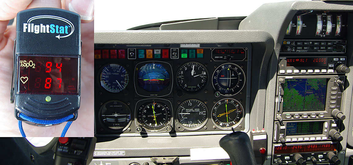
As the inset shows, monitoring of blood oxygen found that the Precise Flow demand regulator was working fine, using a straight cannula. 94% is perfectly fine but at FL200 one needs to breathe very deliberately and take a good deep breath before performing some distracting operation such as a long ATC readback. A mask (which is carried anyway, in case) should work much better and in fact I was unable, with the cannula, to get much better than about 95% oxygen saturation even with constant oxygen flow - a silly flow rate which is pretty unconfortable due to the cold gas going up one's nose.
In Europe, one is supposed to have an 8.33kHz channel spacing radio for FL195 and higher, which I have (KX165A) but I have never seen an 8.33 frequency actually used at FL200 if one is enroute at that level.
A long shortcut from around REM all the way to GUBAR was offered by Paris. The descent from FL200, over the Channel into Shoreham was steep, to say the least.
Total IMC time on this trip was around 5 minutes - the descent from the hold into Zurich. This is not unusual and demonstrates how an IR enables one to avoid weather, airspace issues, and all the other stressful nonsense which causes so much aggravation on a long VFR flight. Many VFR-only pilots believe that an IR is used to fly long periods in cloud but in reality one normally uses the whole-route IFR clearance to avoid IMC enroute.
Most unusually, I had a tailwind on both legs of this trip.
Airborne times were:
EGKA-LSZH 3:00hrs
LSZH-EGKA 2:45hrs
Except as noted, no other aircraft were seen anywhere near my cruise level. At "GA levels", say FL100-FL200, the enroute airspace in Europe is a virtually empty void.
The aircraft performed perfectly. Some notes on Socata TB20 ownership and operation are here.
Pilot: FAA CPL/IR, approx 1000 hours.
Any feedback, reports of dead links, corrections or suggestions much appreciated:
Contact details
This page last edited 14th May 2009